

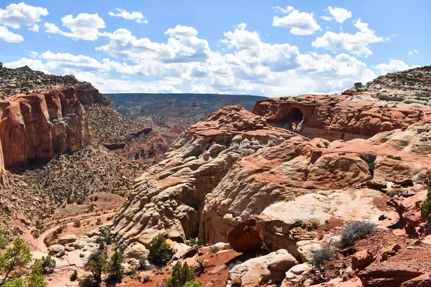
Things to Do in Capitol Reef
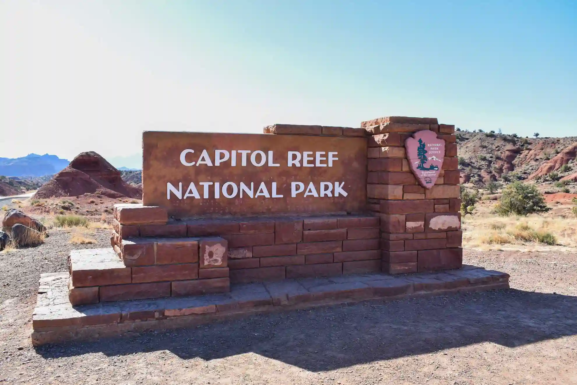
Capitol Reef National Park has three distinct areas: Fruita, the North District (Cathedral Valley), and the South District (Waterpocket Fold). We'll tell you everything there is to see in each one!
ℹ️ If you need practical information, we have a special post on how to visit Capitol Reef
Fruita, the most visited area in Capitol Reef
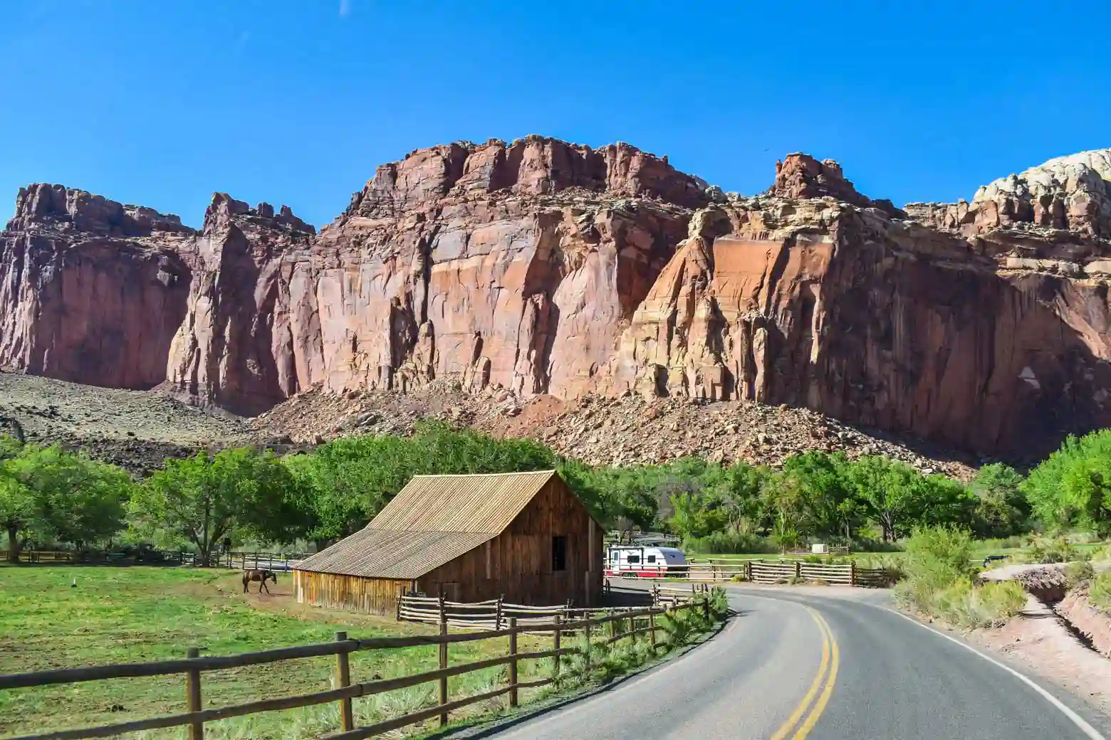
Fruita is a former Mormon settlement founded in 1880 and later abandoned. It is located in a valley at the confluence of the Fremont River and Sulphur Creek, where its founders managed to plant fruit trees and other crops to sustain themselves. It is known that the area had previously been inhabited by Native Americans, as evidenced by various petroglyphs. Today, it is the main area of the national park, home to the visitor center and some of the restored historic houses and orchards.
💡 This area is ideal for hiking, as there are up to 15 different trails that lead to lookout points, canyons, and various rock formations. It’s also the area we recommend visiting if you don’t have a high-clearance 4x4 or don’t want to venture onto unpaved roads.

TRAVEL INSURANCE
FOR THE UNITED STATES
💸 Healthcare in the U.S. is very expensive, and any accident or illness can cost you a fortune.
That's why we recommend getting travel insurance that covers you in case anything goes wrong, so you don't have to pay anything up front.
💡 We always travel with Heymondo because it offers excellent medical coverage at a great price. Plus, you can get 5% OFF*!
🤓 Take a look at: Best travel insurances for the USA | Comparison + Discounts |
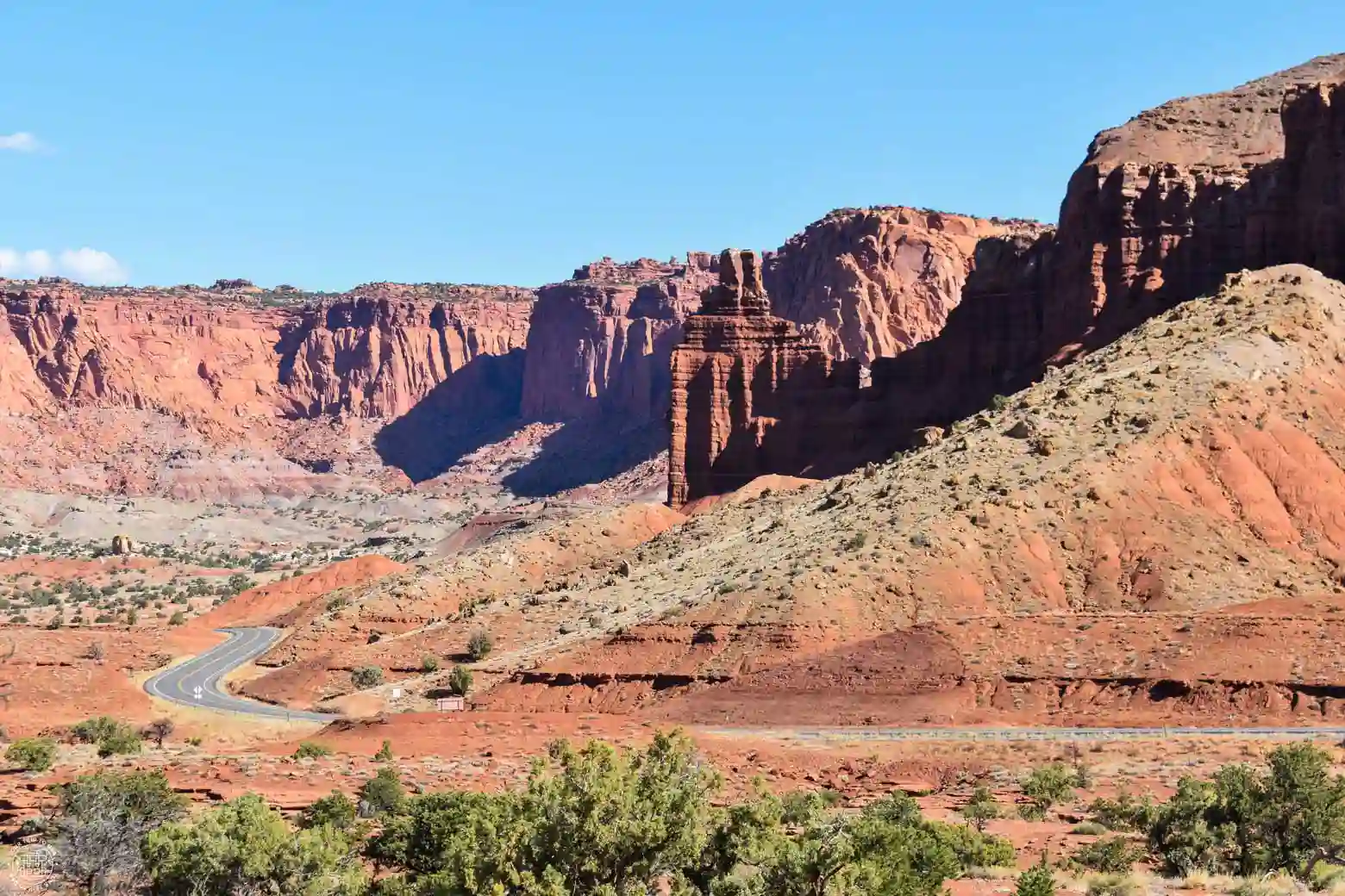
Chimney Rock
This chimney-shaped rock formation is located very close to State Route 24 and is one of the first sights you’ll encounter shortly after entering the park. It features a parking lot and a 3.6 miles (5.9 km) circular trail called Chimney Rock Loop Trail that takes you to various overlooks and the rock formations themselves.
Panorama Point Overlook
If you follow the road toward Fruita, you’ll come to a 1 mile (1.6 km) detour on the right; there are three very interesting overlooks here. The first is Panorama Point Overlook, a viewpoint offering 360° panoramic views of the surrounding area, featuring striking reddish cliffs. It’s especially beautiful at sunset, and at night it’s an ideal spot for stargazing due to the low level of light pollution.
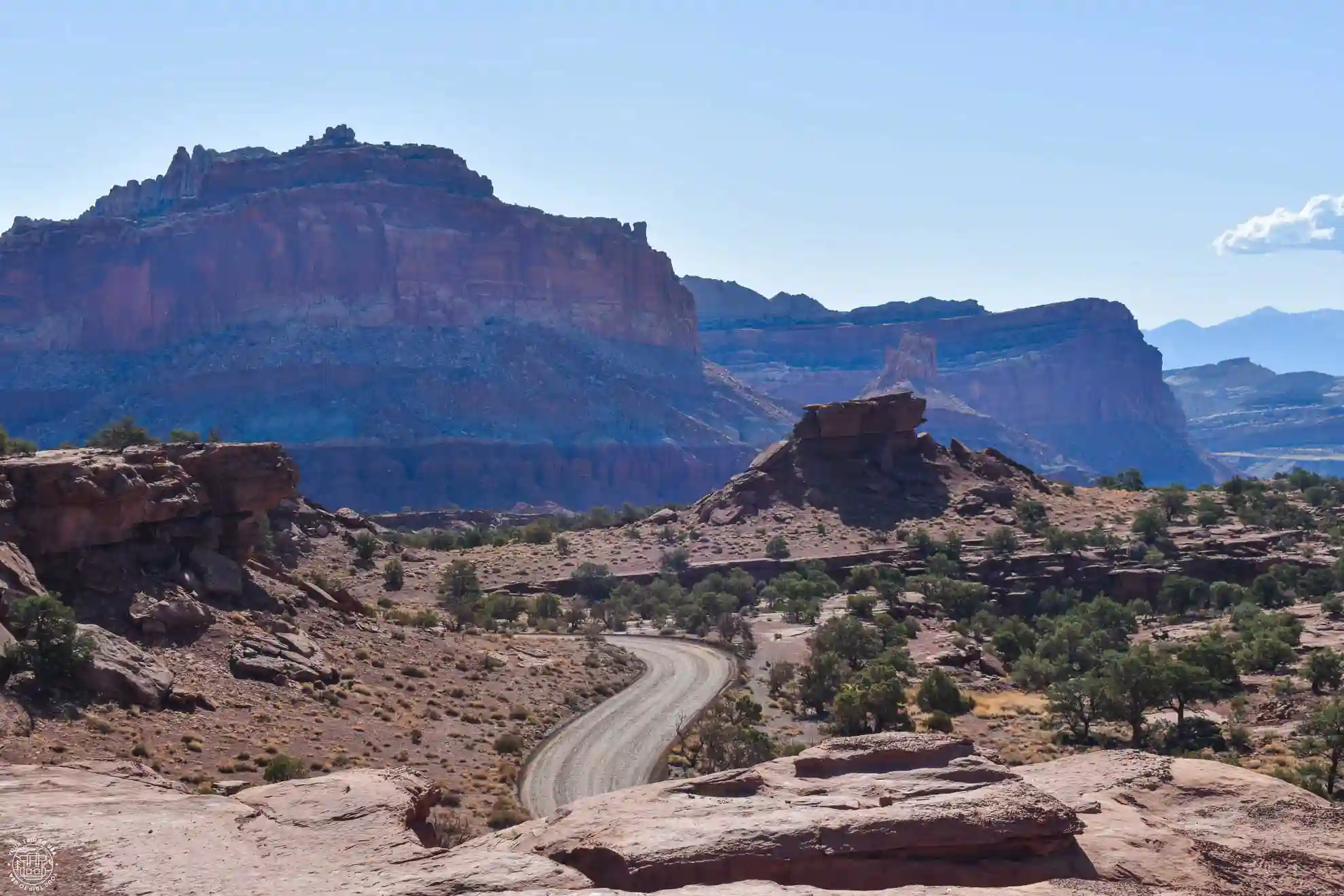
Goosenecks Overlook
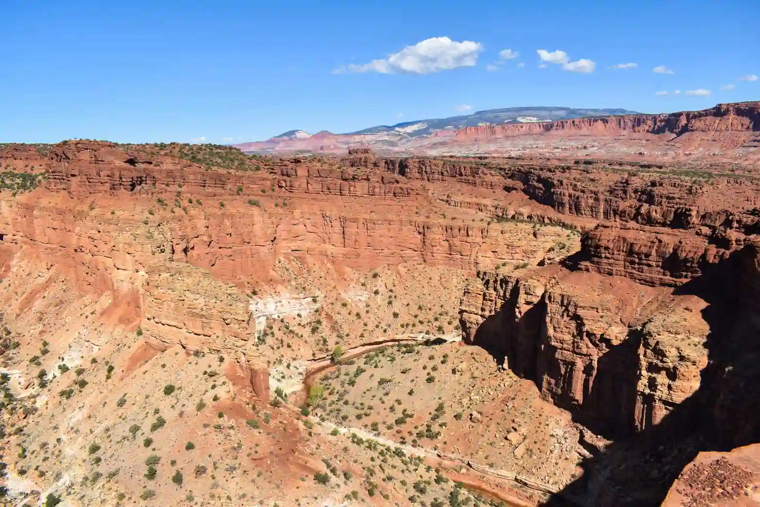
The second lookout along this detour is a beautiful vantage point overlooking the meandering canyon formed by the erosion of Sulfur Creek—you can't miss it! We really liked it.
Sunset Point Overlook
To reach this overlook, you’ll need to take a 0.7-mile or 1.2 km (round-trip) hike with virtually no elevation gain, where you’ll enjoy spectacular views of the mountains that make up the Waterpocket Fold from the west side, within the national park. It’s especially beautiful to visit before sunset and watch the colors of the landscape change.
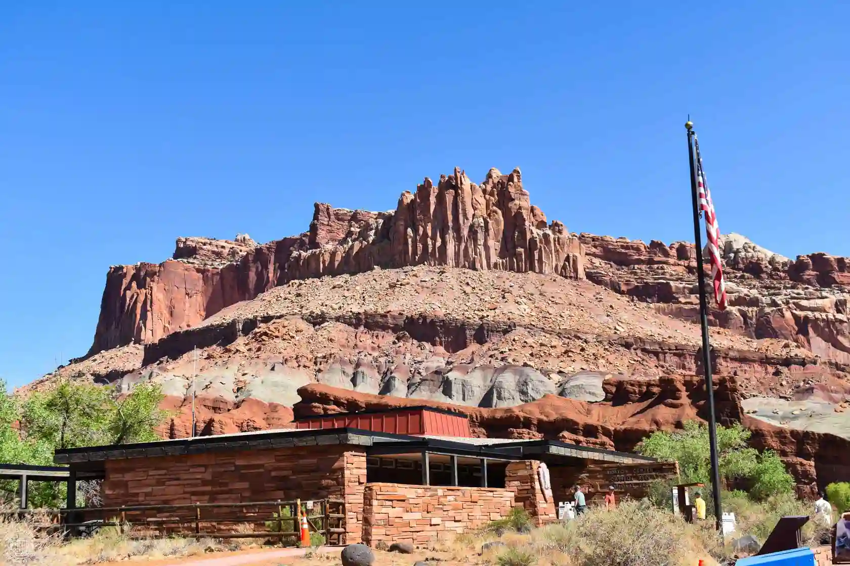
The Castle
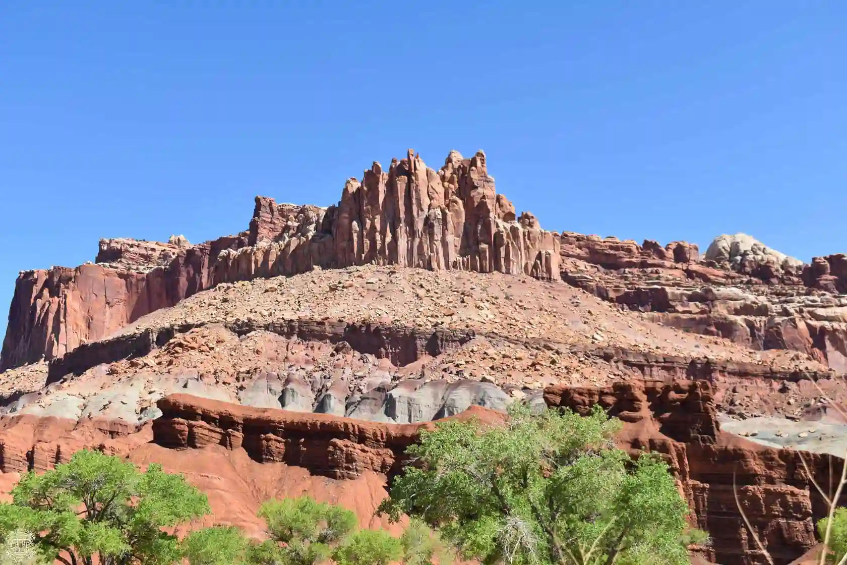
This rock formation, which rises imposingly like a castle above the highway, can be seen clearly from the Visitor Center.
Capitol Reef Scenic Drive
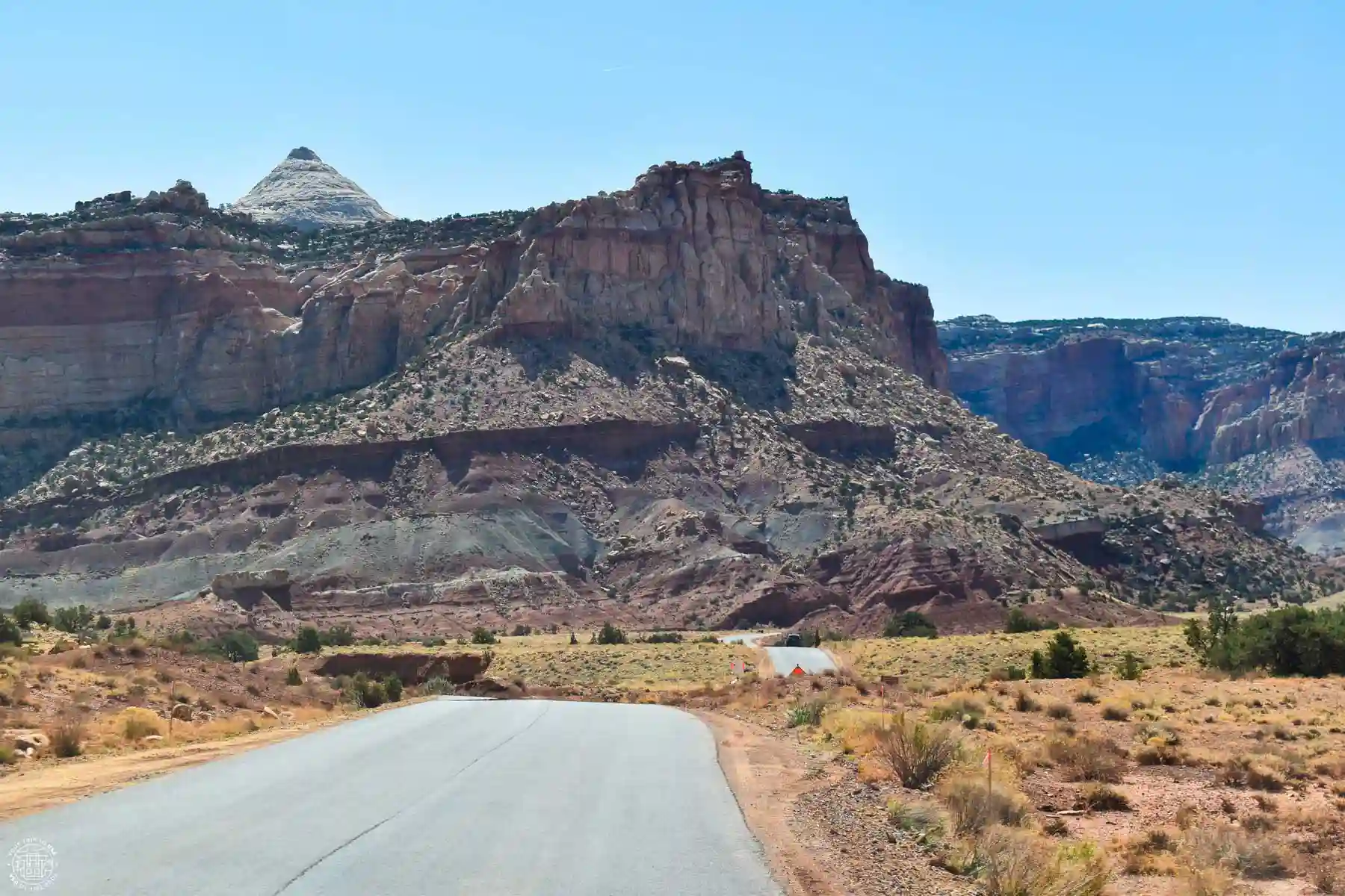
This majestic scenic byway runs along the western side of the Waterpocket Folds from the visitor center to Capitol Gorge, passing through Fruita, and provides access to the national park’s main tourist attractions. Although it isn’t very long—just 8 miles or 13 km (one way)— it allows you to enjoy iconic sites in the park such as the historic town of Fruita and its orchards, the Grand Wash, Capitol Gorge, and several trails within Capitol Reef National Park.
Orchards
The historic orchards planted by Mormon settlers in the Fremont River Valley have been restored by the National Park Service using traditional farming techniques and the same irrigation systems employed by the town’s residents. As a result, during the blooming seasons of the various fruit tree species—from early March to early May—you can see them in full bloom in this arid region of southern Utah.
🍎 In addition, you can also pick your own fruit from early June through mid-October, as the various tree species bear fruit during this time and visitors are allowed to enjoy them—though you must follow a set of rules:
- Pick only the ones with a sign that says "U pick"
- Pick only ripe fruit
- All picked fruit must be paid for at a self-checkout kiosk
- The fenced-in gardens are open from 9 a.m. to 5 p.m.
- The hours for the unfenced gardens are from sunrise to sunset
- Do not climb trees; use the tools provided
- Do not hang hammocks from trees
- Pets are allowed in the gardens if they are on a leash
- Do not touch objects hanging from the branches

RENT A CAR IN THE UNITED STATES
The best way to explore the United States is by car, giving you the freedom to travel at your own pace.
🚗 Whether you’re looking for a convertible Mustang, a 4x4, or a regular car, we recommend to book through this car rental search engine
💸 This is where we find the best prices, both on the rental car itself and on full coverage insurance!
Historic Gifford House
The Gifford family home is part of the Fruita Rural Historical District and is listed on the National Register of Historic Places. Built in 1908 and later restored, the house was home to a Mormon family who lived off their own vegetable gardens until 1969.
It’s now a shop where you can buy reproductions of household items from 100 years ago created by local artists, postcards, jams, and the two star products that make it worth stopping here: their delicious fruit cakes and their ice cream 🥧. Don’t go too late, or you’ll miss out on trying them!
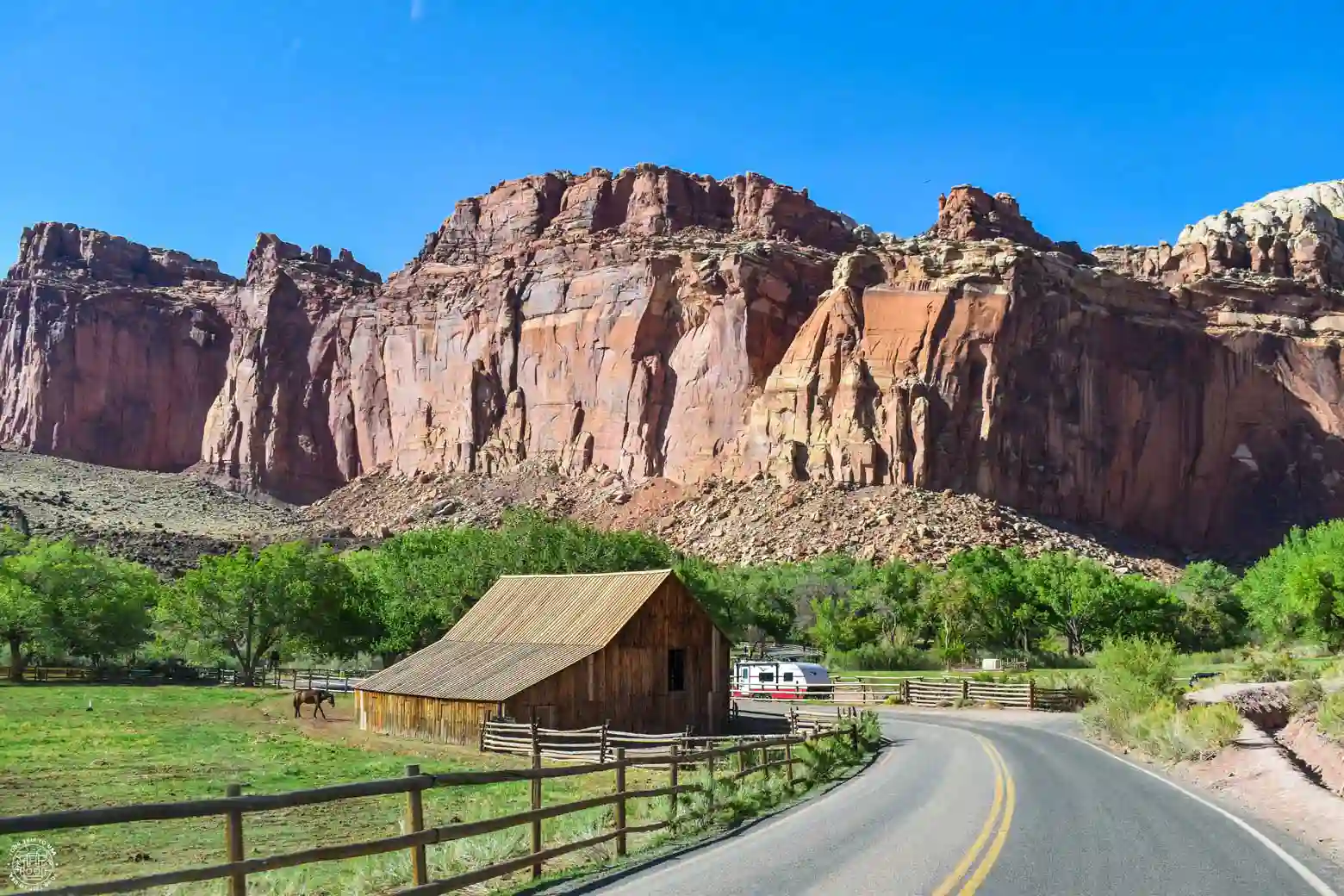
The Pendleton Barn, an old wooden barn very similar to those found in the Mormon Row Historic District of Grand Teton National Park, is also part of the property.
Cohab Canyon Trail
This beautiful canyon, located very close to the historic district and running through the Waterpocket Fold, offers a fantastic opportunity for a hike in Capitol Reef. A 3.4 miles or 5.4 km long (round trip) with an elevation gain of 134 meters, it takes you to two overlooks—the South and North Fruita Overlooks—allows you to see other smaller canyons that flow into it, and offers beautiful panoramic views of the national park.
Since there are two different access points, if you have two cars, you can leave one in Fruita (near the historic district) and the other on Route 24 (at the Hickman Bridge Trailhead), and hike the trail in one direction.
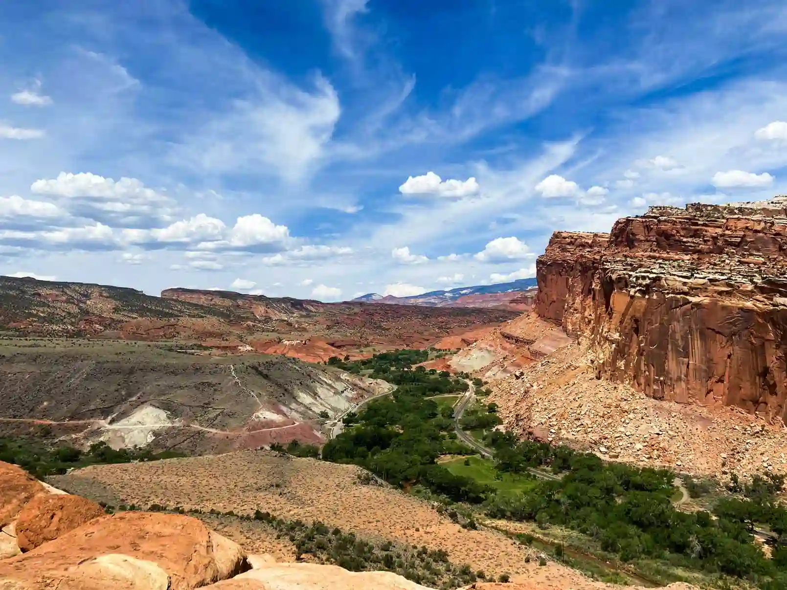
Grand Wash
Grand Wash is another canyon that runs through the Waterpocket Fold, featuring high sandstone walls and a width of 15 feet (4.5 m) at its narrowest point. Like Cohab Canyon, you can hike it one way if you have two cars, or round-trip if you only have one. It’s an ideal spot for a family hike in Capitol Reef, as the trail is 2.2 miles (3.6 km) one way or 4.5 miles (7.2 km) round trip with a 200-foot (61-meter) elevation gain.
To get there from Scenic Road, there is an unpaved trail that leads you to the parking lot at the trailhead; if it's full, you can park your car on the side of the road. From the other access point on Route 24, there is a parking lot on the side of the road that provides direct access to the trail.
In addition, one of Capitol Reef's best hiking trails—the Cassidy Arch Trail—also begins at the Scenic Road entrance.
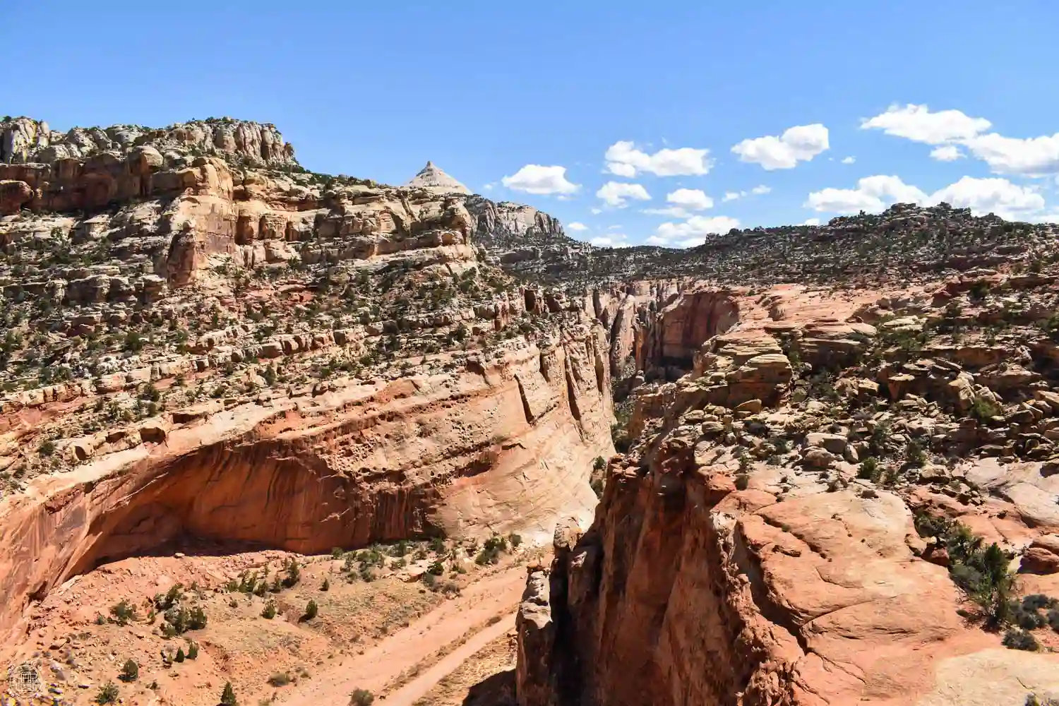
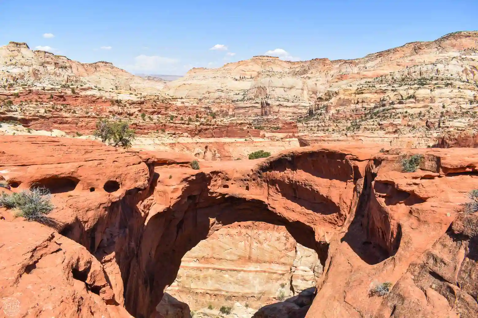
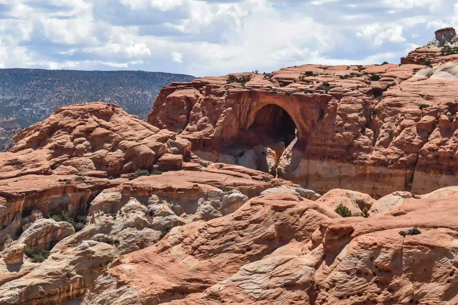
Cassidy Arch
After visiting tons of natural arches and bridges—especially in southern Utah at places like Zion National Park, Bryce Canyon National Park, Escalante, Arches National Park, and Natural Bridges National Monument—we have to tell you that this one was one of the ones that impressed us the most. 😮
It’s a very large arch that you can see in the distance as you approach, and because of its shape, it looks more like a man-made bridge than a natural arch. Up close, it’s truly impressive since it’s located right on the edge of the cliff—and you can even walk across it. The views of the surrounding area are magnificent, and best of all: you’ll likely be practically alone, enjoying this natural wonder.
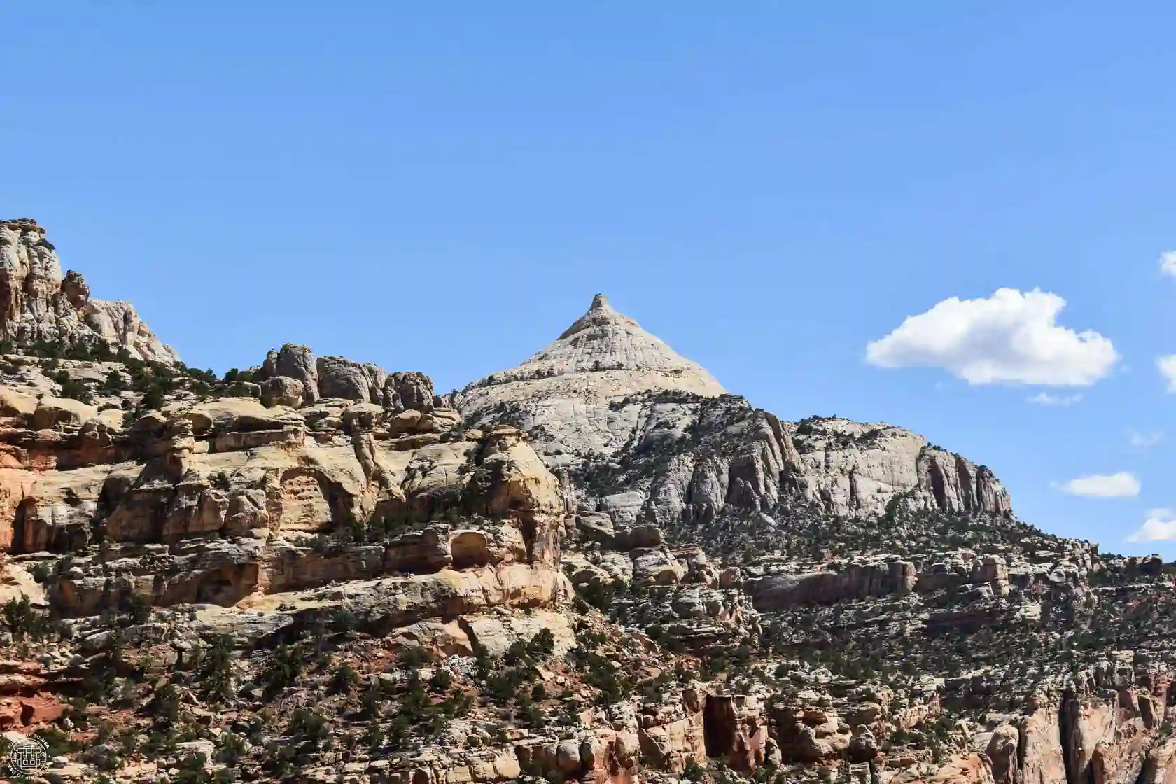
Ferns Nipple
It is one of the most distinctive peaks in the entire national park and can be seen clearly from the Cassidy Arch Trail. Standing 7,063 feet (2,153 meters) tall, its name supposedly comes from its resemblance to the nipple of Butch Cassidy’s girlfriend—one of the most famous outlaws of the American West. Her name was Fern, and the rest is history. 🤣
Slickrock Divide
This is the highest point on the Capitol Reef Scenic Drive. From here, rainwater flows toward either Grand Wash or Capitol Gorge, depending on whether it falls on one side or the other of the cliff. There is a small parking lot off to the side where you can enjoy the views.
Egyptian Temple
This reddish rock formation with its bizarre shapes is one of the stops along the Scenic Drive. It’s called the Egyptian Temple because of its supposed resemblance to an Egyptian temple—you really have to use your imagination to see it! 😅
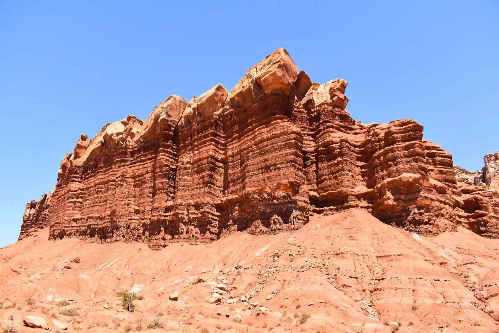
Capitol Gorge
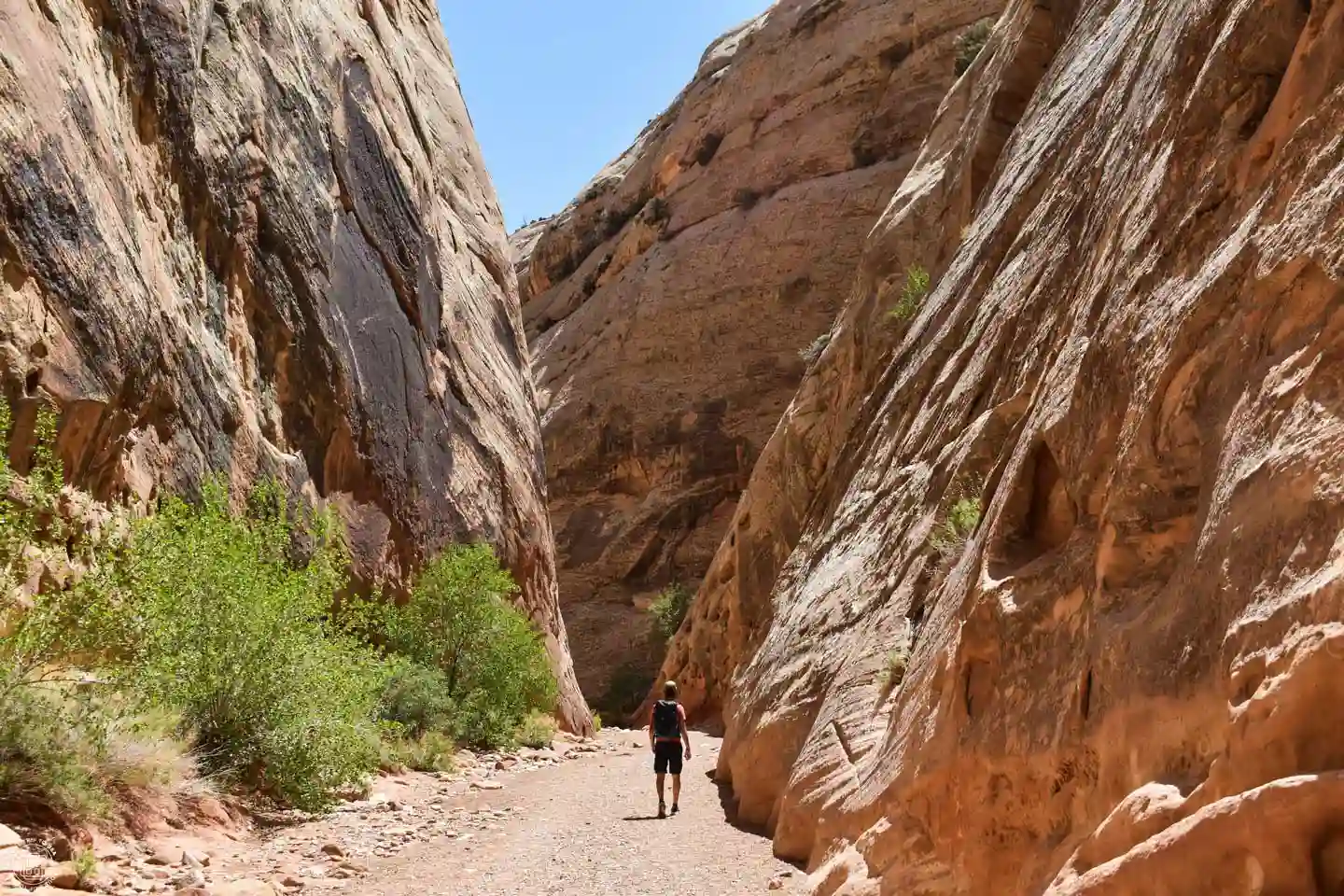
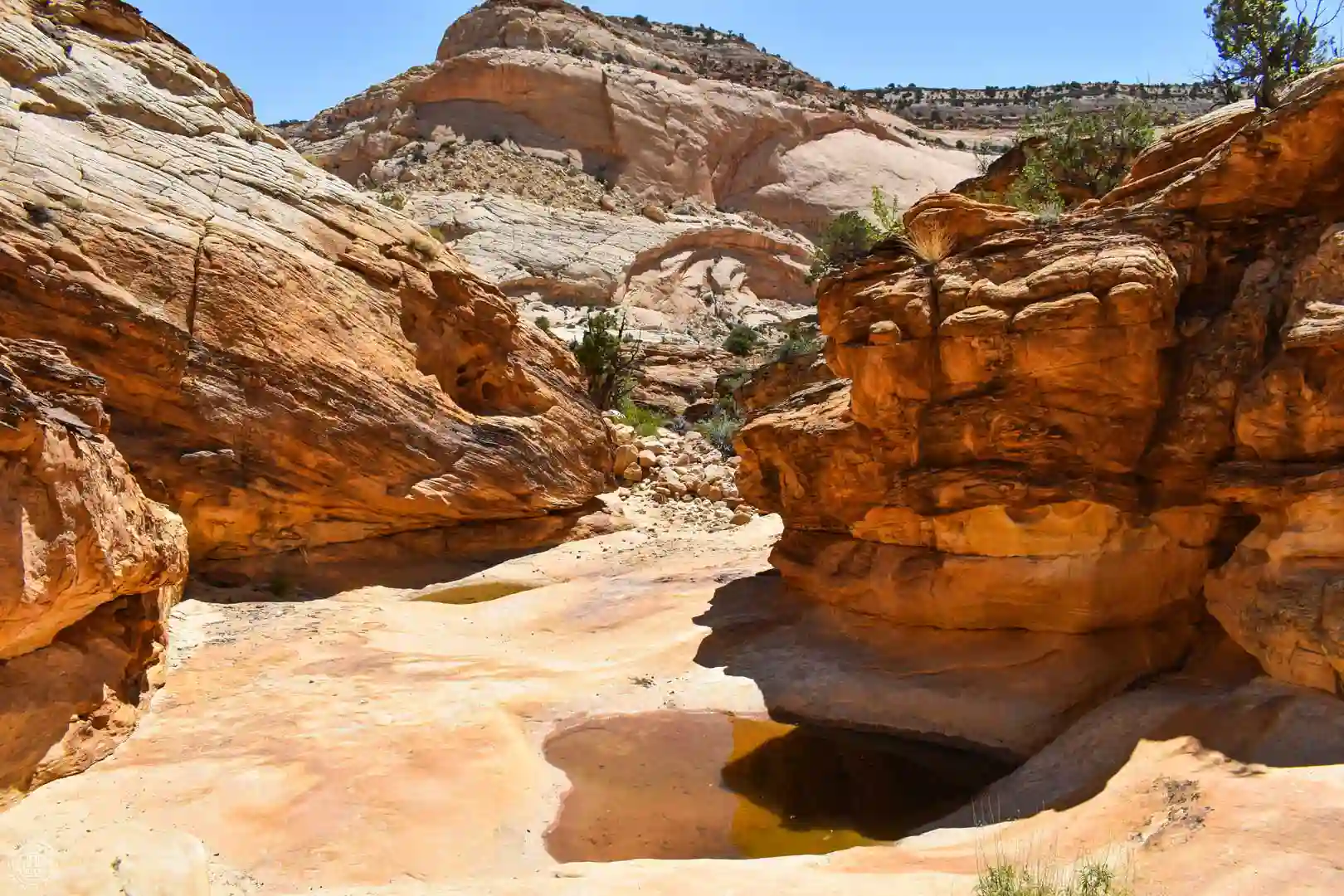
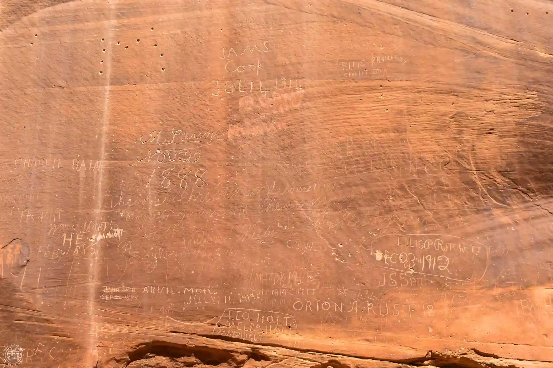
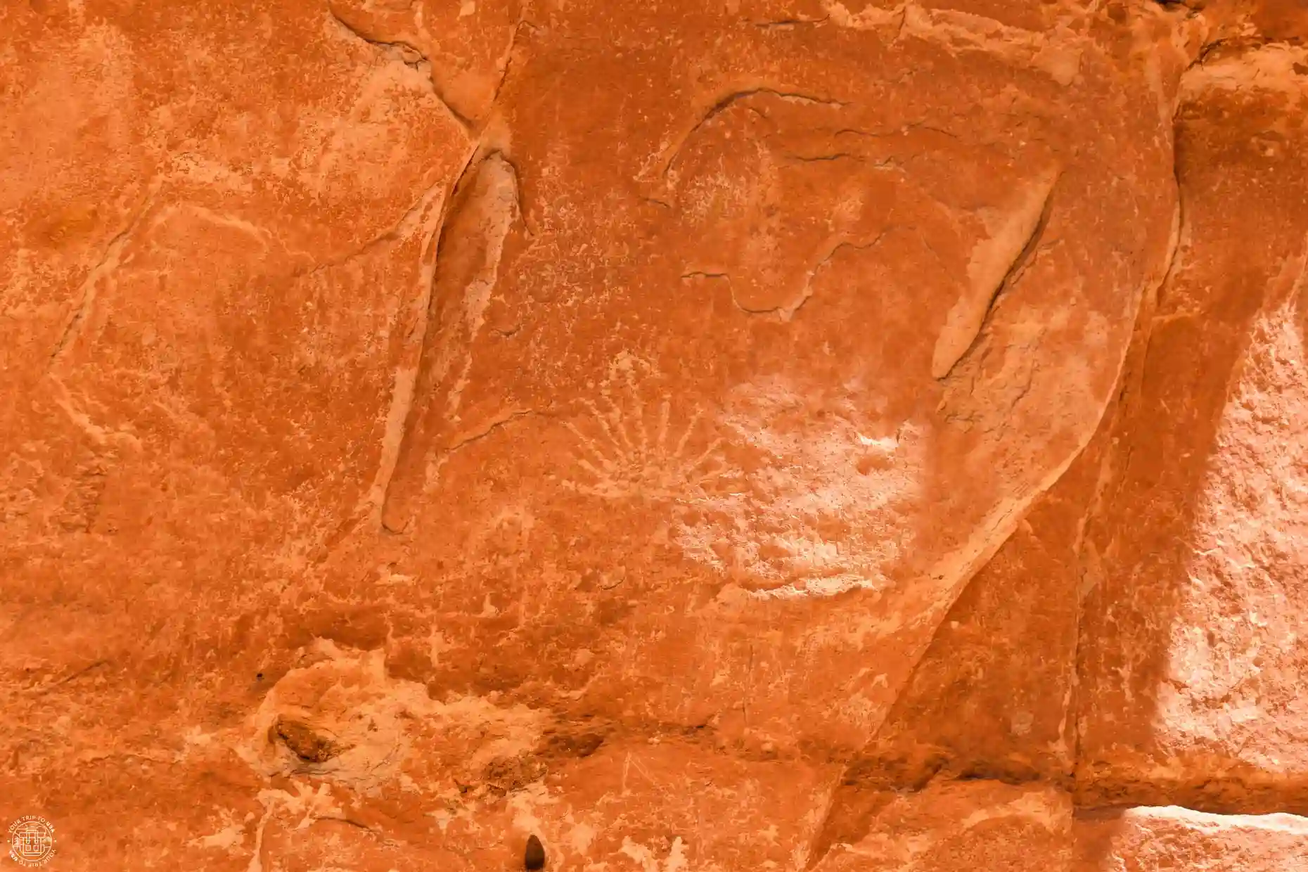
Capitol Gorge, a beautiful gorge carved into the rock by water and wind, marks the end of the Scenic Drive. An easy 2 miles or 3.2 km (round-trip) trail with a 78-feet (24 m) elevation gain takes you to several points of interest, such as petroglyphs carved by indigenous peoples, the Pioneer Register (graffiti left by some of the first white settlers who passed through the area more than 100 years ago), and the Tanks Trail, a short but steep trail leading to a series of pools formed by water erosion in the rock.
These types of pools give their name to one of the park's main features, the Waterpocket Fold—a spectacular geological formation 160 km long, created by the folding and erosion of rock layers over millions of years.
Golden Throne
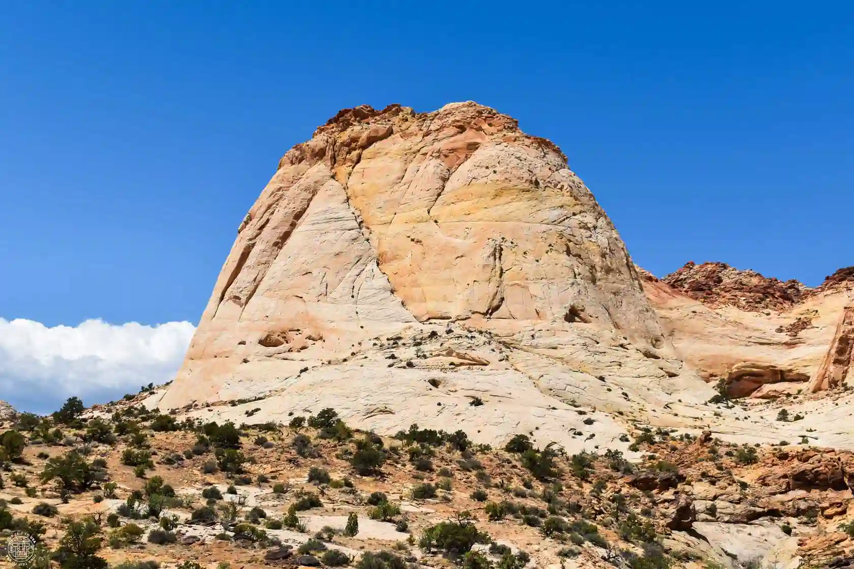
Another of the park's iconic mountains is the Golden Throne, located south of the Fruita area and famous for its shape and the golden color of its sandstone cliffs. A good viewpoint is the Tanks Trail, which branches off from the Capitol Gorge.
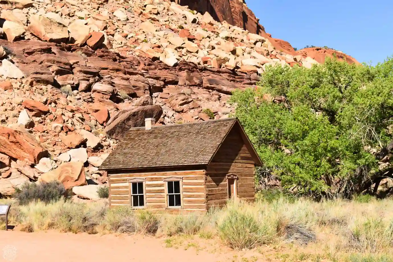
Historic Fruita School
This tiny wooden building was the old school in Fruita. Built in the late 19th century, it once had as many as 22 students of all ages, and its first teacher was a local girl who began teaching at age 12. It remained in operation until 1941, when enrollment was too low to justify its upkeep, and it was closed. In 1989, the National Park Service restored it to its original 1930 condition.
But this humble building served as more than just a school. In such a small community, it was used for a variety of purposes, including as a meeting place, a church, a dance hall, a venue for elections, church youth activities, community dinners, and celebrations.
Today, you can visit the exterior of the building and its surroundings; it is located off Highway 24, 0.9 miles (1.5 km) from the visitor center in the direction of Hanksville.
Petroglyphs
Not far from the school are several panels of petroglyphs. Attributed to the Fremont culture, which inhabited the state of Utah for nearly 1,000 years, they can be viewed via two wooden walkways. If you want to see them more clearly, it’s best to bring binoculars, as they’re high up on the cliff face.
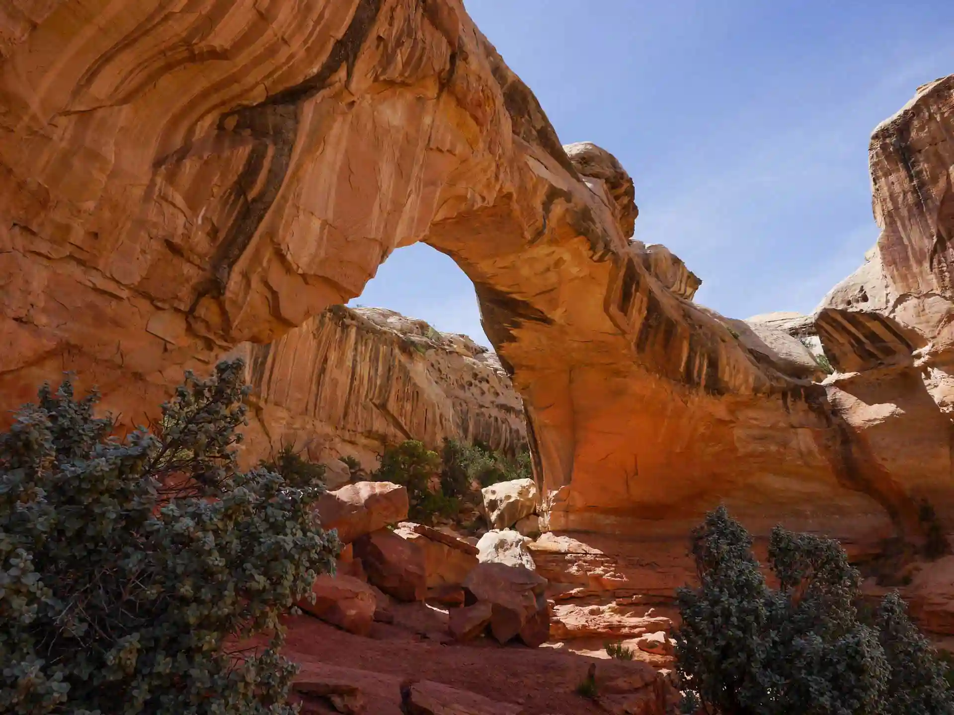
Hickman Bridge
This elegant natural bridge, 124 feet (38 m) high and 131 feet (40 m) long, is located in the central part of Capitol Reef National Park and is one of the most beautiful in the area. Although it is very close to Highway 24, it cannot be seen from the road. You’ll need to park in a designated parking lot and hike the 1.7 miles or 2.8 km (round-trip) trail with a 400-foot (122 m) elevation gain to see it. The hike is considered moderately difficult due to the elevation gain.
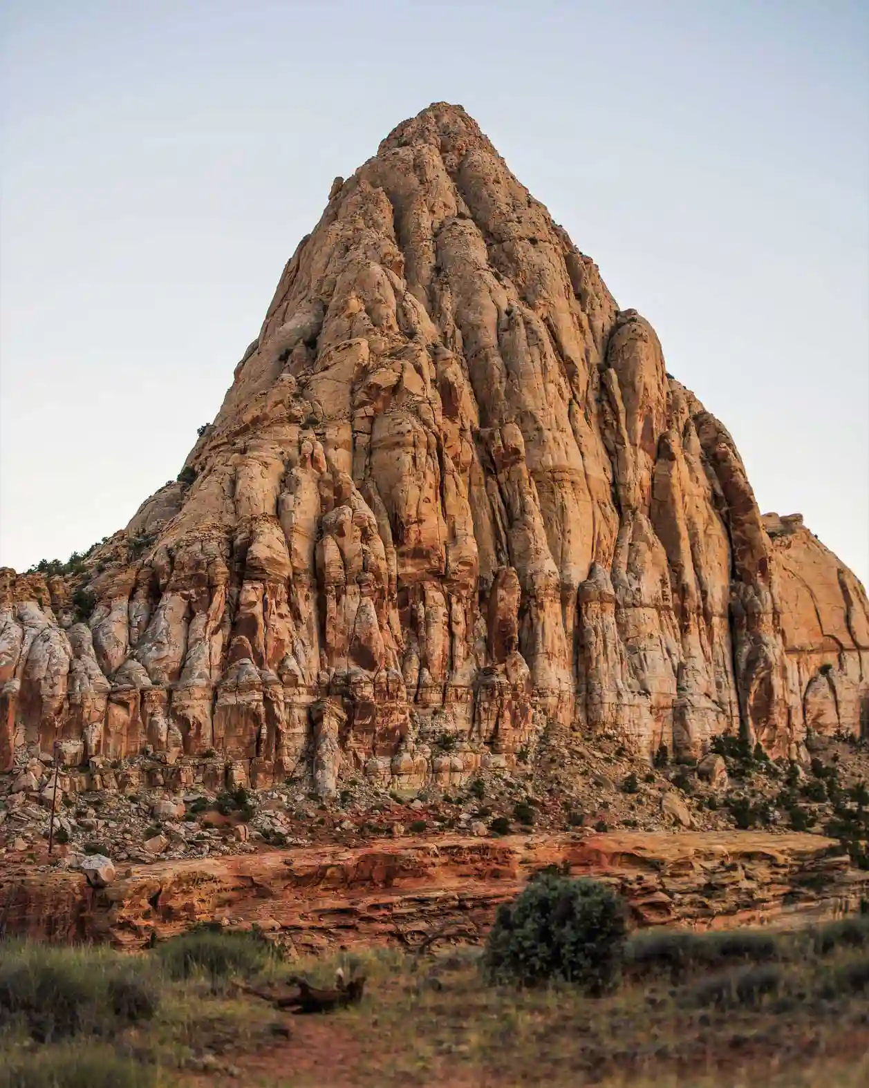
Pectols Pyramid
This 6,210-foot-high (1,893 m) sandstone peak, with its varied colors, is located east of the town of Fruita and is one of the park's most beautiful and frequently photographed spots. You can see it from Highway 24 itself or from the parking lot at the Hickman Bridge Trailhead.
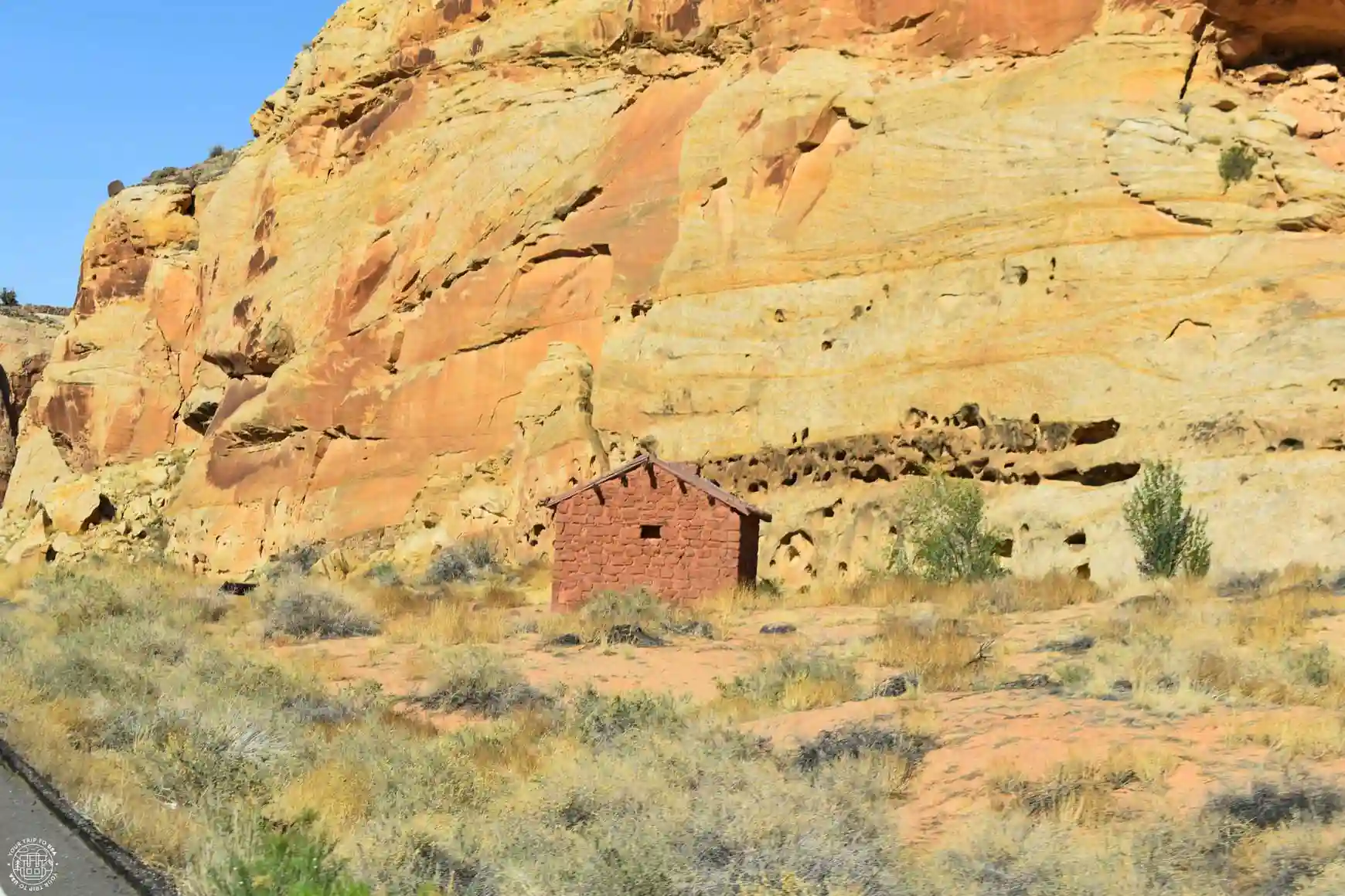
Behunin Cabin
This small cabin was built in 1883 by the Behunin family, who had 13 children 😮. It was so small that only the couple and their youngest children could sleep inside; the rest had to sleep outside. The girls slept in a wagon and the boys in a small cave! The crops they tried to plant were washed away by a flood, so under these conditions, they only lasted one year there.
It has been listed on the National Register of Historic Places since 1999 and can be viewed from the outside. It is located next to Highway 24, and there is a gravel parking lot where you can park.
South District (Waterpocket Fold)
The southern part of the park is characterized by the Strike Valley and the Waterpocket Fold. This geological feature, which runs almost the entire length of the park from north to south, is most evident in this part of the park. Where these two formations meet is the most beautiful part, as you can observe the different stages of erosion in the various layers that make them up, creating a unique combination of shapes, textures, and colors.
To get there , take Notom-Bullfrog Road, which branches off Route 24 and leads to Lake Powell. It is partially paved and is generally suitable for all types of vehicles, although road conditions may change due to inclement weather. It’s advisable to check road conditions at the Fruita Visitor Center before heading out.
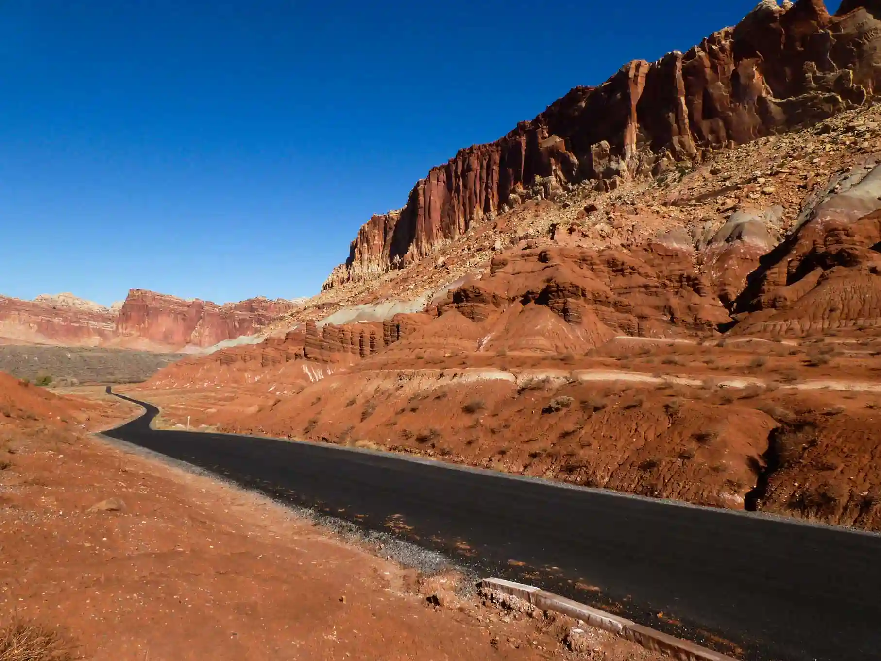
Another way to get there is via Burr Trail Road, which connects this part of the park with the town of Boulder on Scenic Route 12. This road passes through several canyons in the vicinity of the national park, such as Long Canyon Slot, and crosses the Waterpocket Fold until it reaches Notom-Bullfrog Road. Here you’ll find the best viewpoint in the area, the Strike Valley Overlook, although reaching it requires a high-clearance 4x4 because the last 3 miles (5 km) may be in poor condition.
Burr Trail Road is paved except for the 5 miles (8 km) that run through the park, but it is well-maintained and, in principle, can be driven on with any vehicle.

The best way to explore this entire area is to take a circular drive along both roads. You can start at the intersection of Highway 24 and Notom-Bullfrog, heading south to Burr Trail, and turn right onto that road until you reach Boulder. From there, take Scenic Route 12 to Torrey, and from there, head back to the starting point via Highway 24 again. This route will take you a full day, as the total distance is 200 km.
Another of the main overlooks in this area is the Halls Creek Overlook, from which you can see canyons carved into the rock over millions of years and the various layers of colorful sediment that make up the Waterpocket Fold. The only drawback is that it’s located 48 miles (77 km) off Highway 24 along the Notom-Bullfrog Road, and the last 3 miles (5 km) of the turnoff to the overlook are unpaved, so a high-clearance 4x4 is recommended.
North District (Cathedral Valley)
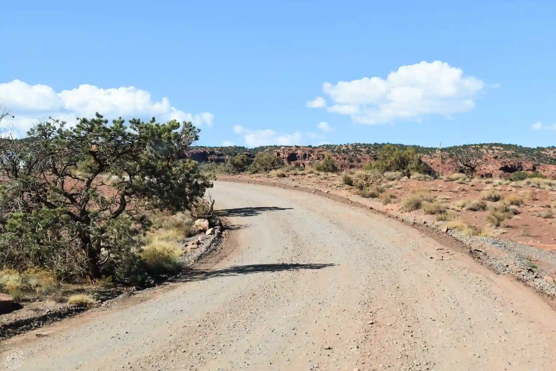
The northern part of the park, called Cathedral Valley, is amazing. Its desert landscapes, dotted with incredible rock formations that look like they were created by artificial intelligence, will leave you speechless. The only drawback is that to get there, it’s best to have a high-clearance 4x4 vehicle, since the roads leading there are unpaved and receive minimal maintenance.
These two roads are Cathedral Valley Road and Hartnet Road; both branch off from Route 24 and are located in Cathedral Valley, making for a spectacular loop. This 56-mile (93 km) route is rarely visited, so you’ll encounter very few people along the way.
It is important to stop by the visitor center before setting out on the trail and check its conditions, as rain may have made some sections impassable.

-Sites: Temple of the Sun, Temple of the Moon,
Cathedral Valley and more
-Includes: 4x4 transportation and guide
-Duration: 4 hours
Here's a description of the route, starting at Cathedral Road and proceeding counterclockwise:
Cathedral Road
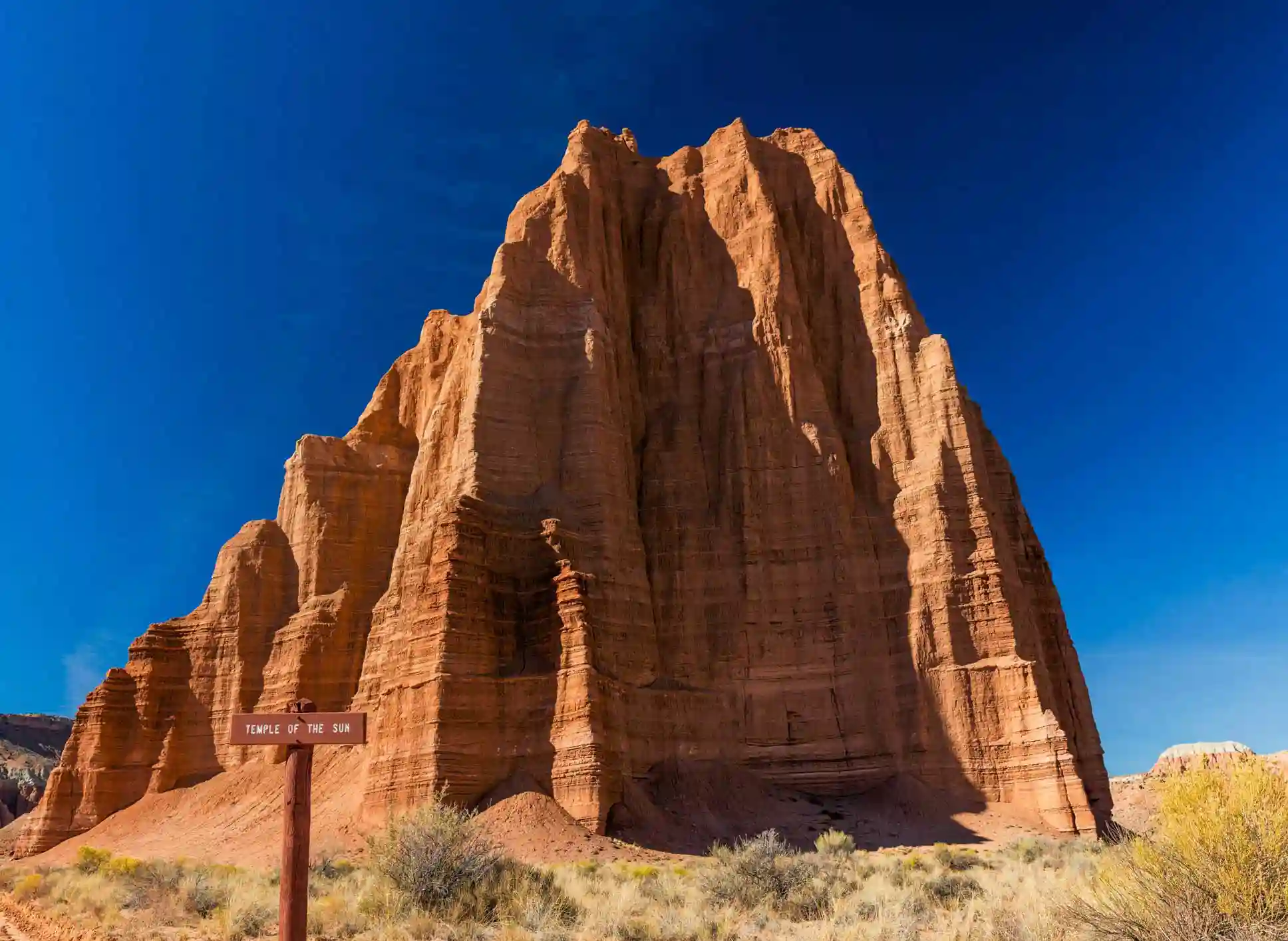
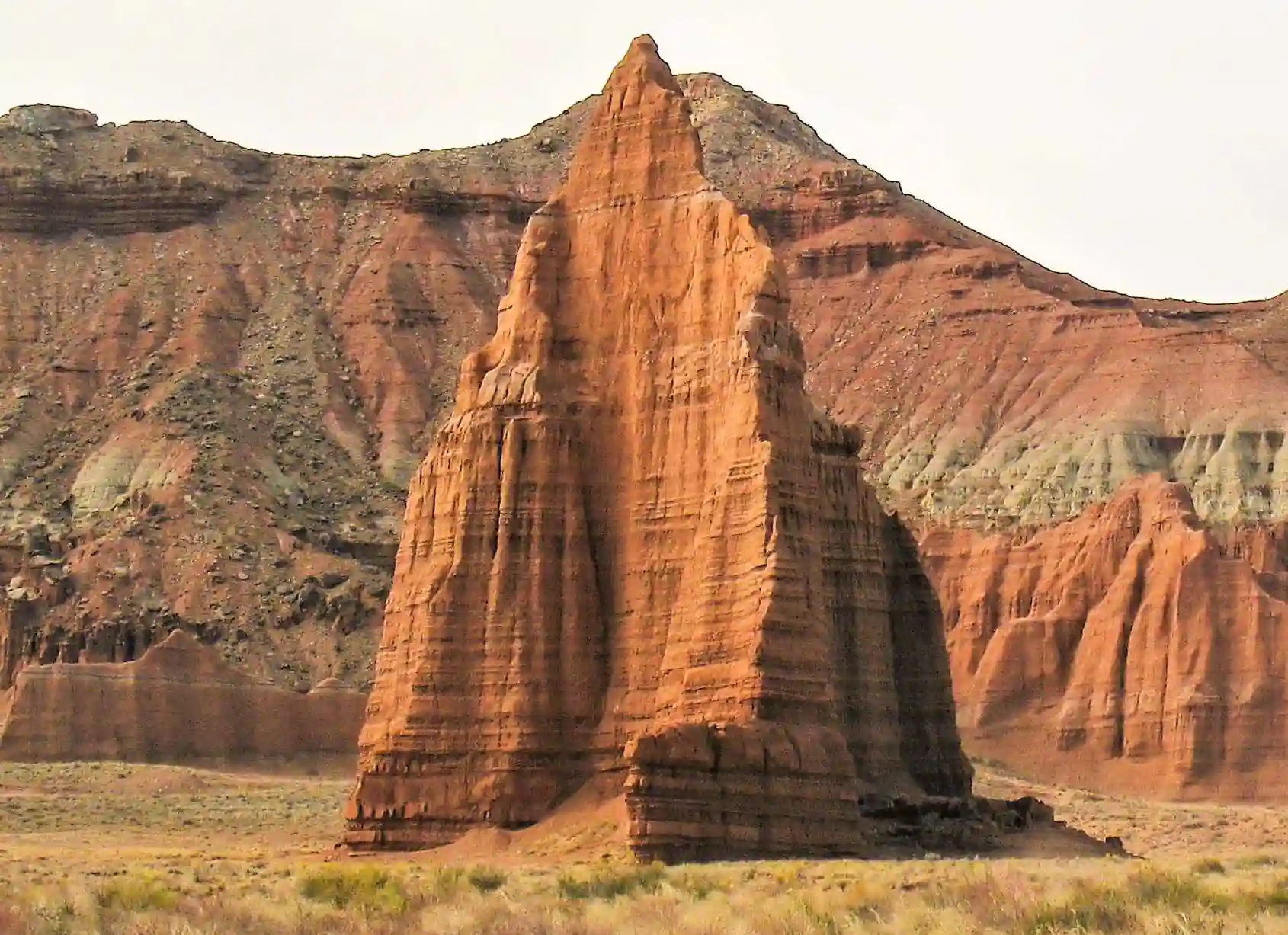
This road is home to some of the park’s most famous rock formations, such as the Temple of the Sun and the Temple of the Moon, which are separated by just 2,000 feet (600 m). Both are monoliths made of Entrada sandstone—the same rock that forms Arches National Park—rising 394 and 299 feet (120 and 91 m), respectively, above the surrounding landscape. You won’t want to miss them!
Very close to these two is another strange rock formation you shouldn't miss: Glass Mountain. It is a mound of sparkling selenite crystals, a variety of gypsum. This gypsum was deposited by underground rivers that flowed beneath the sandstone millions of years ago and began to crystallize, forming a plug. As the sandstone eroded and disappeared, this plug was exposed.
ℹ️ To reach all of these rock formations, you'll need to take a short detour of 5.3 miles or 8.6 km (round trip) from Cathedral Road.
Shortly before the intersection with Hartnet Road, 2.4 miles (3.9 km) away, there’s a really cool trail. It’s the Cathedrals Trail, an easy 2.4 miles or 3.9 km (round-trip) hike that runs along a ridge and parallel to a group of rock formations known as the Cathedrals.
Hartnet Road
If you continue northwest on Cathedral Road, you’ll reach the intersection with Hartnet Road, where there’s a rustic campground and two spectacular overlooks: the Upper Cathedral Valley Overlook and the Upper South Desert Overlook. The first offers a panoramic view of Cathedral Valley, and the second overlooks the northern part of the South Desert and the surrounding mountains and cliffs. Each is located on a different side of the road, so the views are different, and both require a short detour.
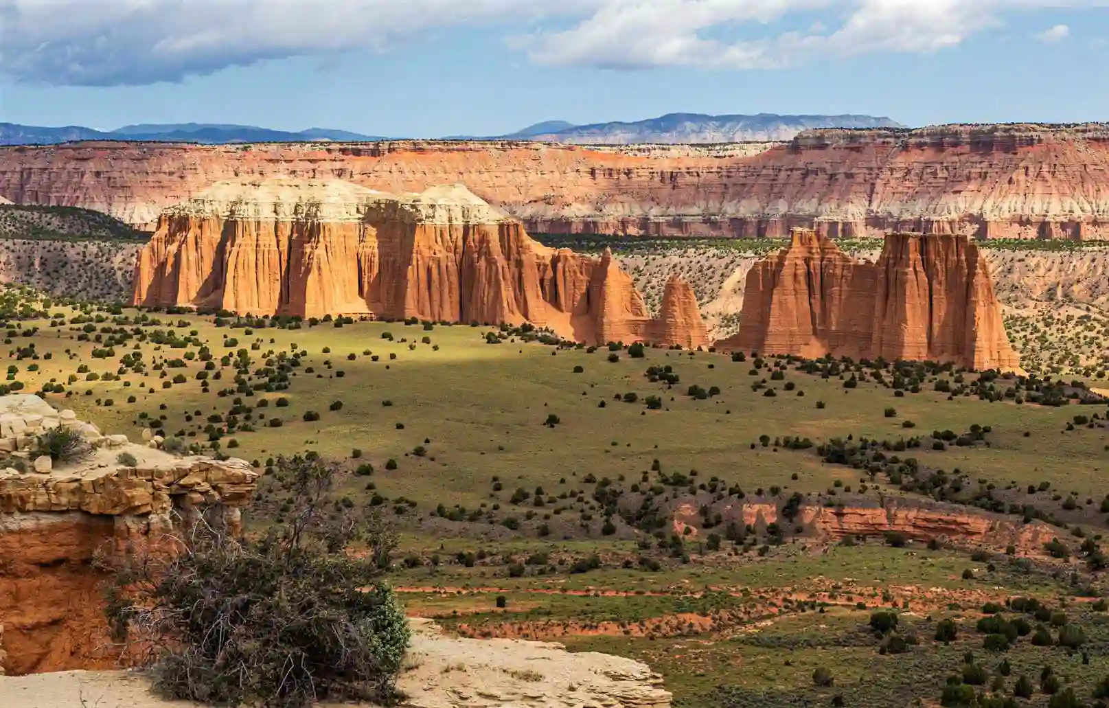
If you continue south on Hartnet Road, you'll come to the Lower Cathedral Valley Overlooks. To reach these two overlooks, you'll need to hike between 1.5 and 2.4 miles or 2.5 and 3.9 km (round trip), but you'll be rewarded with bird's-eye views of the Temple of the Sun and the Temple of the Moon, as well as Lower Cathedral Valley.
The last of the overlooks along this road is the Lower South Desert Overlook, which offers a breathtaking panoramic view of this desert in the northern part of the national park, featuring Jailhouse Rock—another rock formation that rises imposingly in the middle of nowhere.
Before you reach the end of the road, keep an eye on the scenery on either side, as there is a stretch of bentonite mountains with their characteristic bluish hues. To finish this adventure route, all you have to do is ford the Fremont River—don't try to cross it if the water level is too high or there's a flash flood!

INTERNET IN THE UNITED STATES
💡 The most convenient way to get internet access in the U.S. is to buy an eSIM—that way, you'll have a connection as soon as you set foot in the country. Plus, local SIM cards in the U.S. are pretty expensive.
💸 We have 2 discounts for your unlimited data eSIM for the US:
⭐5% OFF with Holafly ➡️ Excellent coverage
⭐20% OFF with eSIMFlag ➡️ Best price
🤓 Take a loot at: Best SIMs & eSIMs for traveling to the USA
What to See in Half a Day at Capitol Reef
If you only have half a day in Capitol Reef, we recommend visiting the Fruita area and going on a hike. This route is designed for travel from Escalante or Bryce Canyon heading east.
🏨 The night before, we'd stay in Escalante at the Ponderosa Inn or in Bryce Canyon City at the Bryce View Lodge if you're coming from this national park.
First, we’d take a brief tour of the overlooks along the way before reaching the visitor center, such as Panorama Point, Goosenecks Overlook, and Sunset Point. Then we’d continue on to the visitor center to explore and learn more about the park, and finally we’d head to the Historic Gifford House to buy a souvenir or enjoy one of their delicious cakes.
Next, we’d drive along Scenic Drive, and if you like hiking, we wouldn’t miss Cassidy Arch for anything in the world. After this tour, we’d head back toward Route 24, and on the way to your next destination, we’d stop briefly to see the petroglyphs, the Historic Fruita School, and/or the Behunin Cabin.
What to See in One Day at Capitol Reef
If you have one day in Capitol Reef, we recommend visiting the Fruita area and going on a couple of hikes. This route is designed for travel from Escalante or Bryce Canyon heading east.
🏨 The night before, we'd stay in Escalante at the Ponderosa Inn or in Bryce Canyon City at the Bryce View Lodge if you're coming from this national park.
We would make the same stops as on the half-day tour of Capitol Reef, but we’d also add a walking tour of Capitol Gorge and the trail to The Tanks. Another option would be to visit only the northern area to explore the sandstone formations of Cathedral Valley, but this is only possible if you have a high-clearance 4x4 or book a guided tour to Cathedral Valley.
🏨 That night, we'd be staying in Caineville at the Cathedral Valley Inn. If you'd like to explore other options, we have a dedicated post on where to stay in Capitol Reef.
 NO FEES CARD FOR THE UNITED STATES
In the U.S., you'll pay for almost everything by card. If you use one from your regular bank, you'll get hit with a ton of currency conversion fees.
💡 That's why we recommend to get the Wise card. There's no maintenance fee, and you can:
💸 Withdraw $250/month in any currency with no fees
💳 Do payments in any currency with no extra fees
What to See in 2 Days at Capitol Reef
If you have two days in Capitol Reef, we recommend visiting the Fruita area and going on a couple of hikes on the first day, then spending the second day driving the loop through the South District. This route is designed for travel from Escalante or Bryce Canyon heading east.
🏨 The night before, we'd stay in Escalante at the Ponderosa Inn or in Bryce Canyon City at the Bryce View Lodge if you're coming from this national park.
On the first day, we would follow the same route as the one-day tour, and on the second day, we would spend the day exploring the southern part of the park, driving along Notom-Bullfrog Road to Strike Valley, then continuing along Burr Trail Road to Boulder and finally returning to the starting point via Scenic Road 12 and Route 24, just as we’ve explained here.
If you have a high-clearance 4x4, on the second day we’d recommend visiting the northern part of the park, taking this loop route that takes you deep into the spectacular Cathedral Valley.
🏨 We'd be staying both nights in Caineville, at the Cathedral Valley Inn. If you'd like to explore other options, we have a dedicated post on where to stay in Capitol Reef.
What to See in 3 Days at Capitol Reef
If you have 3 days in Capitol Reef, we recommend visiting the Fruita area and going on a couple of hikes on the first day, spending the second day driving the loop through the South District, and on the third day—if you have a high-clearance 4x4—visiting the North District. If you don’t have this type of vehicle, you can book this tour to Cathedral Valley. This route is designed for travel from Escalante or Bryce Canyon heading east.
🏨 The night before, we'd stay in Escalante at the Ponderosa Inn or in Bryce Canyon City at the Bryce View Lodge if you're coming from this national park.
On the first day, we would follow the same route as the one-day tour, and on the second day, we would spend the day exploring the southern part of the park, driving along Notom-Bullfrog Road to Strike Valley, then continuing along Burr Trail Road to Boulder and finally returning to the starting point via Scenic Road 12 and Route 24, just as we’ve explained here.
We’d spend the third day exploring one of the most beautiful and remote areas of the national park: Cathedral Valley. Given its beauty, it should be a much more popular destination, but the need for a high-clearance 4x4 vehicle causes many people to rule it out—though you can take this tour to Cathedral Valley with transportation and a guide and forget about driving.
🏨 We would be staying all 3 nights in Caineville, at the Cathedral Valley Inn. If you'd like to explore other options, we have a dedicated post on where to stay in Capitol Reef.
What to Do Around Capitol Reef
Even though it's a fairly remote area in southern Utah, there are literally endless things to do near Capitol Reef.
Escalante
The tiny town of Escalante is the main gateway to Staircase-Escalante National Monument, and we have an exclusive post on what to see and do in Escalante. Don't miss it!
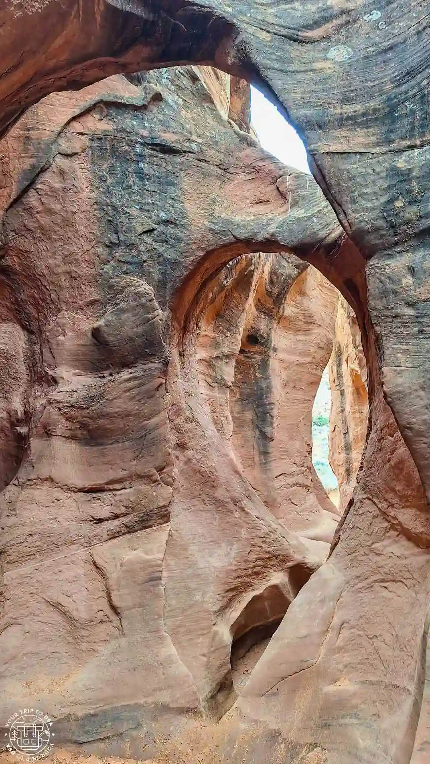
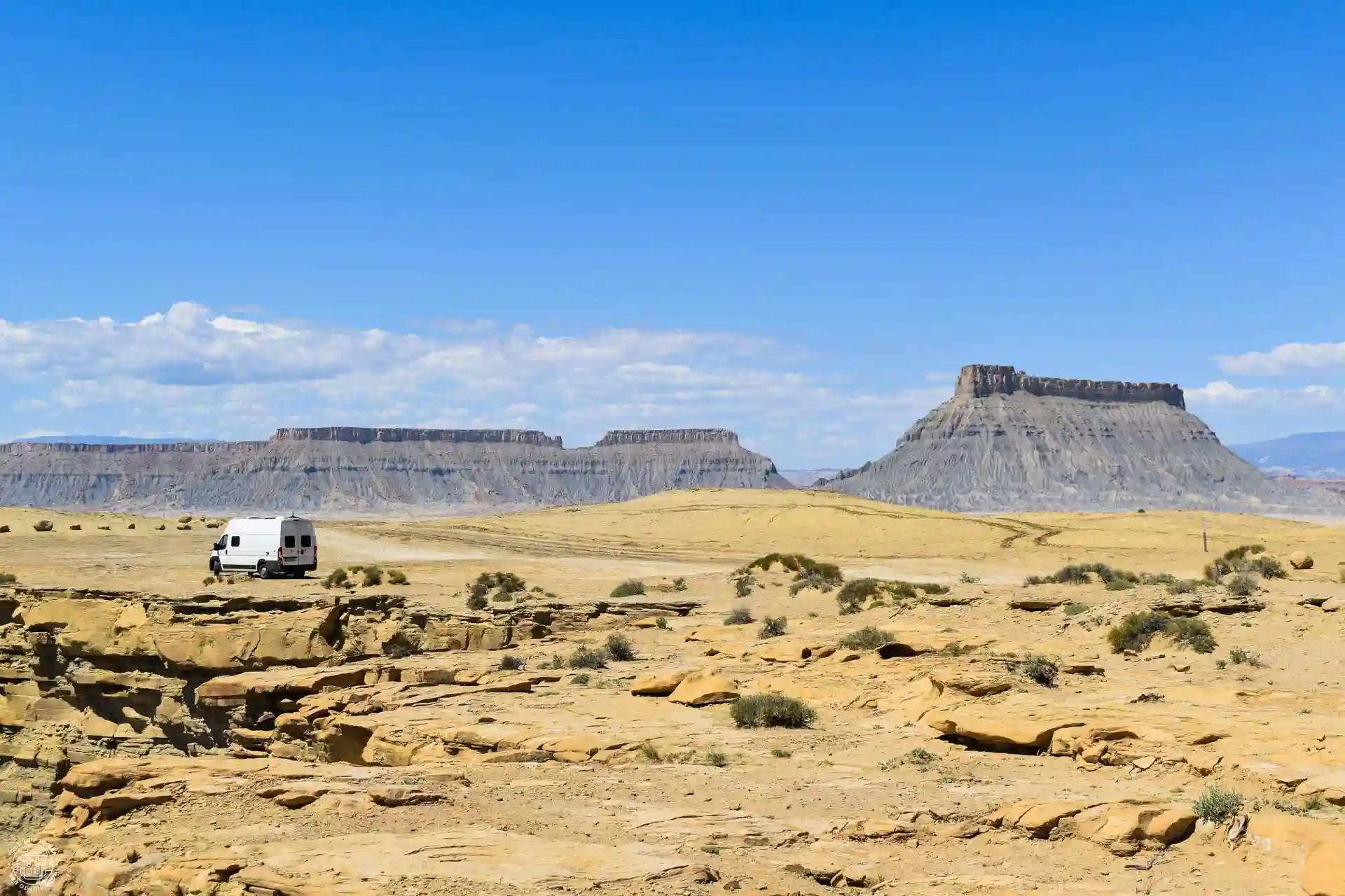
Factory Butte y Moonscape Overlook
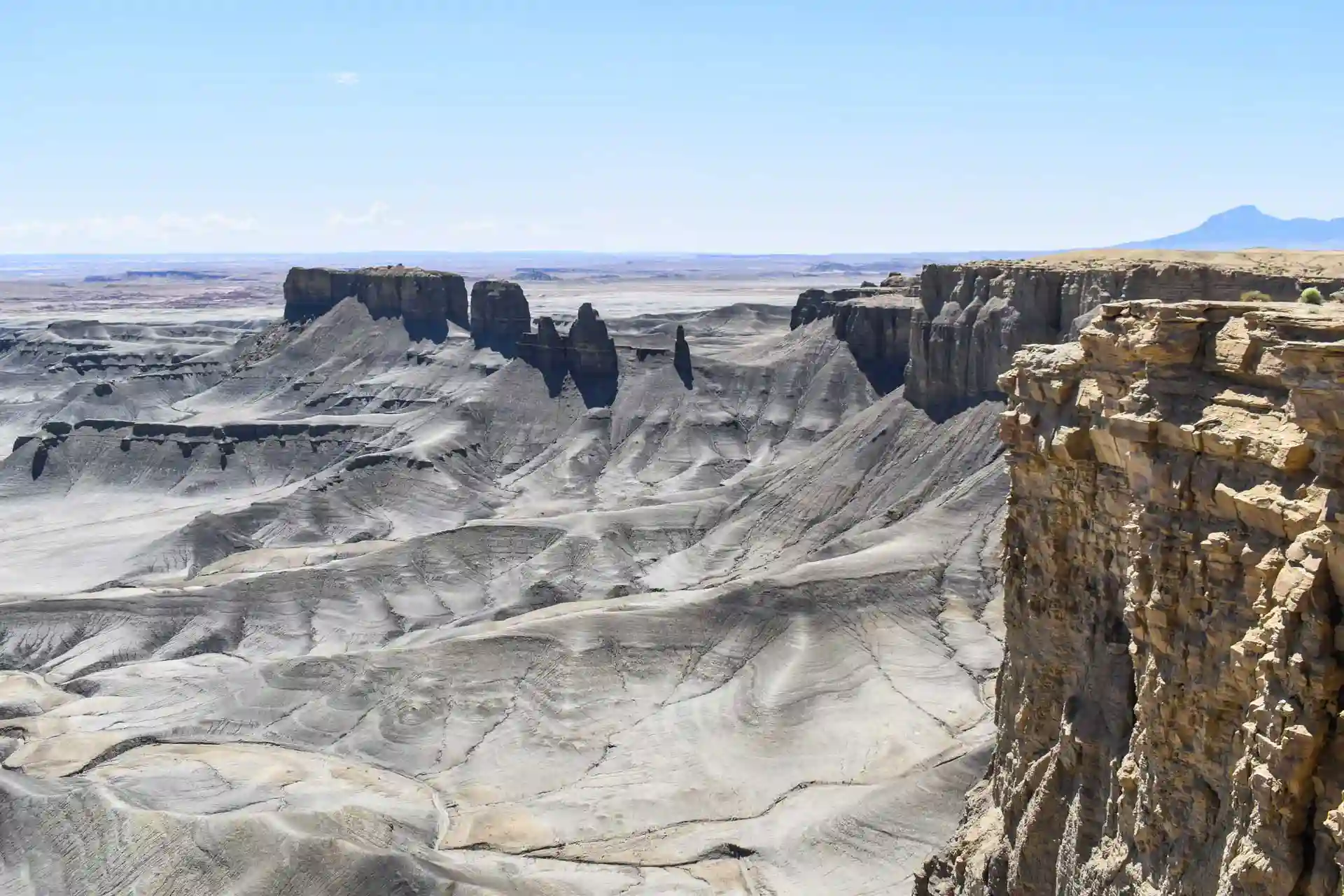
Factory Butte and Moonscape Overlook are two of the most breathtaking and little-known spots in southern Utah, which is why we've written an exclusive post on how to visit Factory Butte and Moonscape Overlook (coming soon).
💡 If you'd prefer to be accompanied by a professional guide with transportation included from Torrey, we recommend this tour to Factory Butte and Moonscape Overlook.
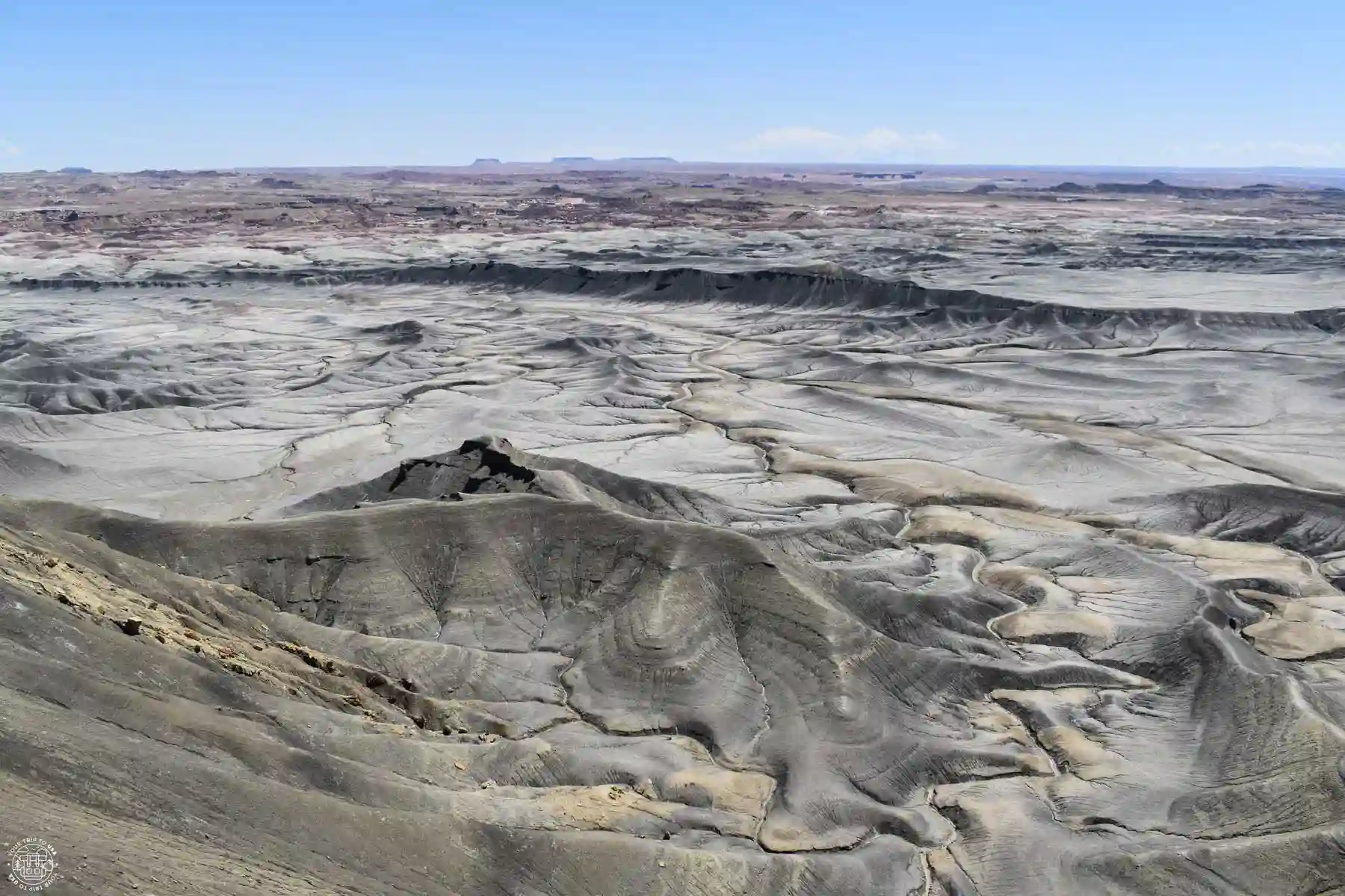
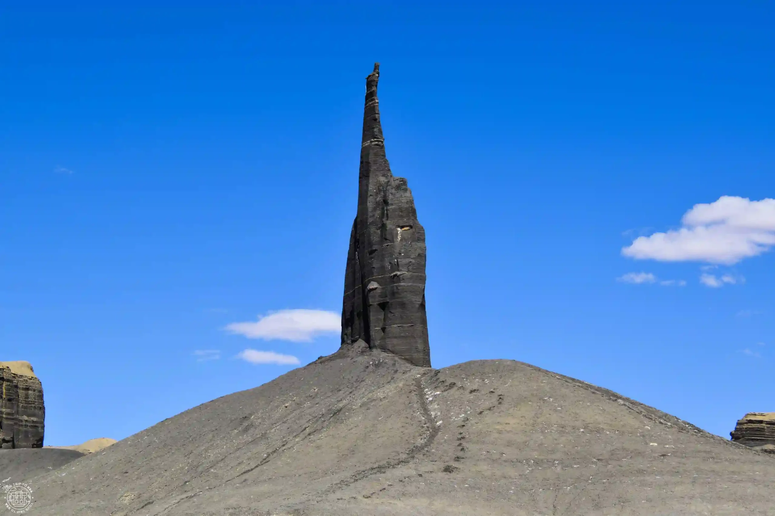
Long Dong Spire
Another incredible spot in southern Utah—it really looks like something out of a Star Wars movie, or as if you've been teleported for a moment to the surface of Mars. As you might expect, we also have a post on how to visit Long Dong Spire (coming soon).
Bentonite Hills
Another one! They can prick me all they want—I won't bleed! How is it possible that there are so many natural wonders all together in such a relatively short distance!
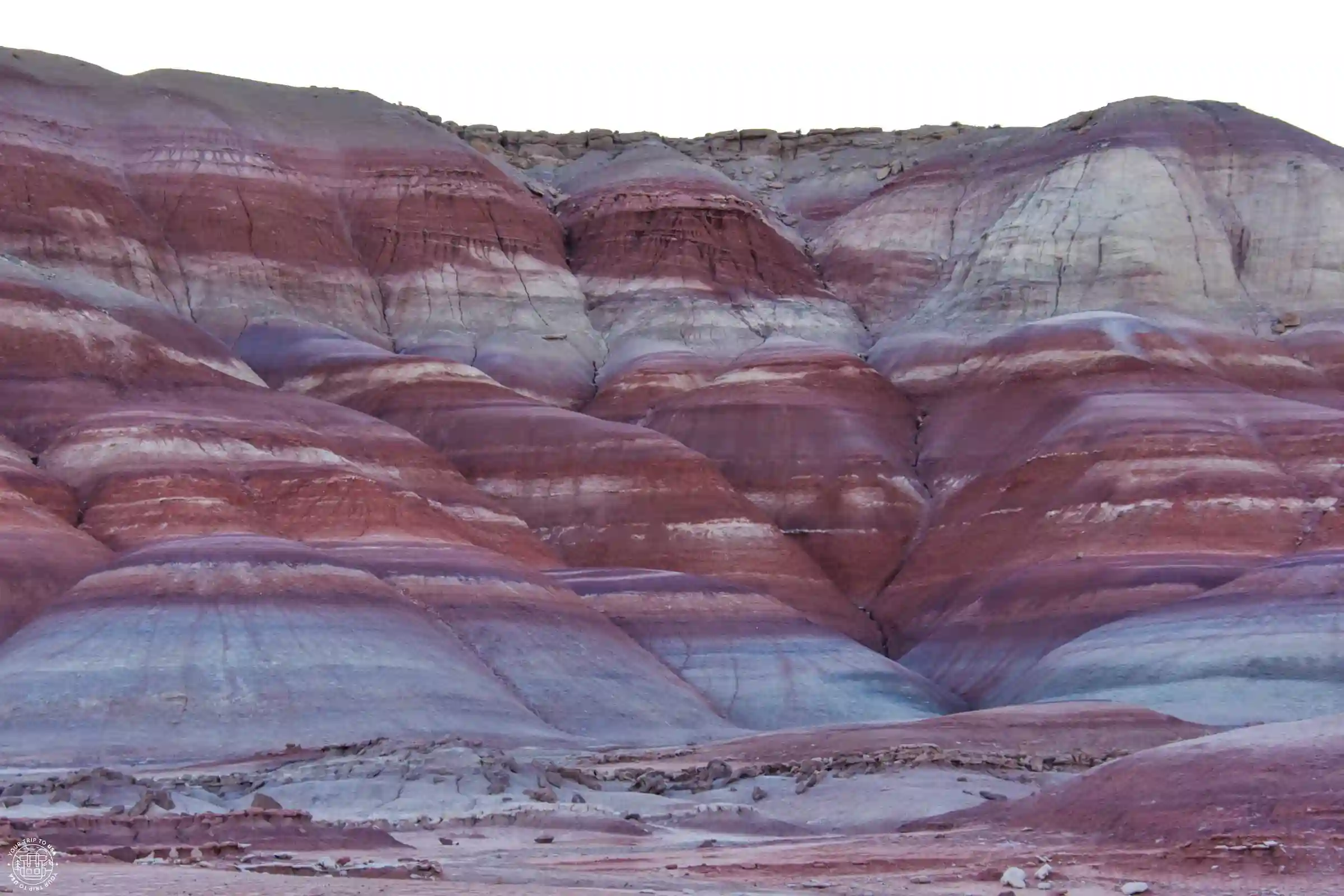
These mountains, with their rounded shapes and colors ranging from blue to ochre to red, create a landscape you shouldn't miss if you're in the area. We’ve written an exclusive post on how to visit the Bentonite Hills (coming soon) to help you plan your trip there. Plus, unlike the ones in the North District of Capitol Reef, you can get there in any vehicle.
Hanksville
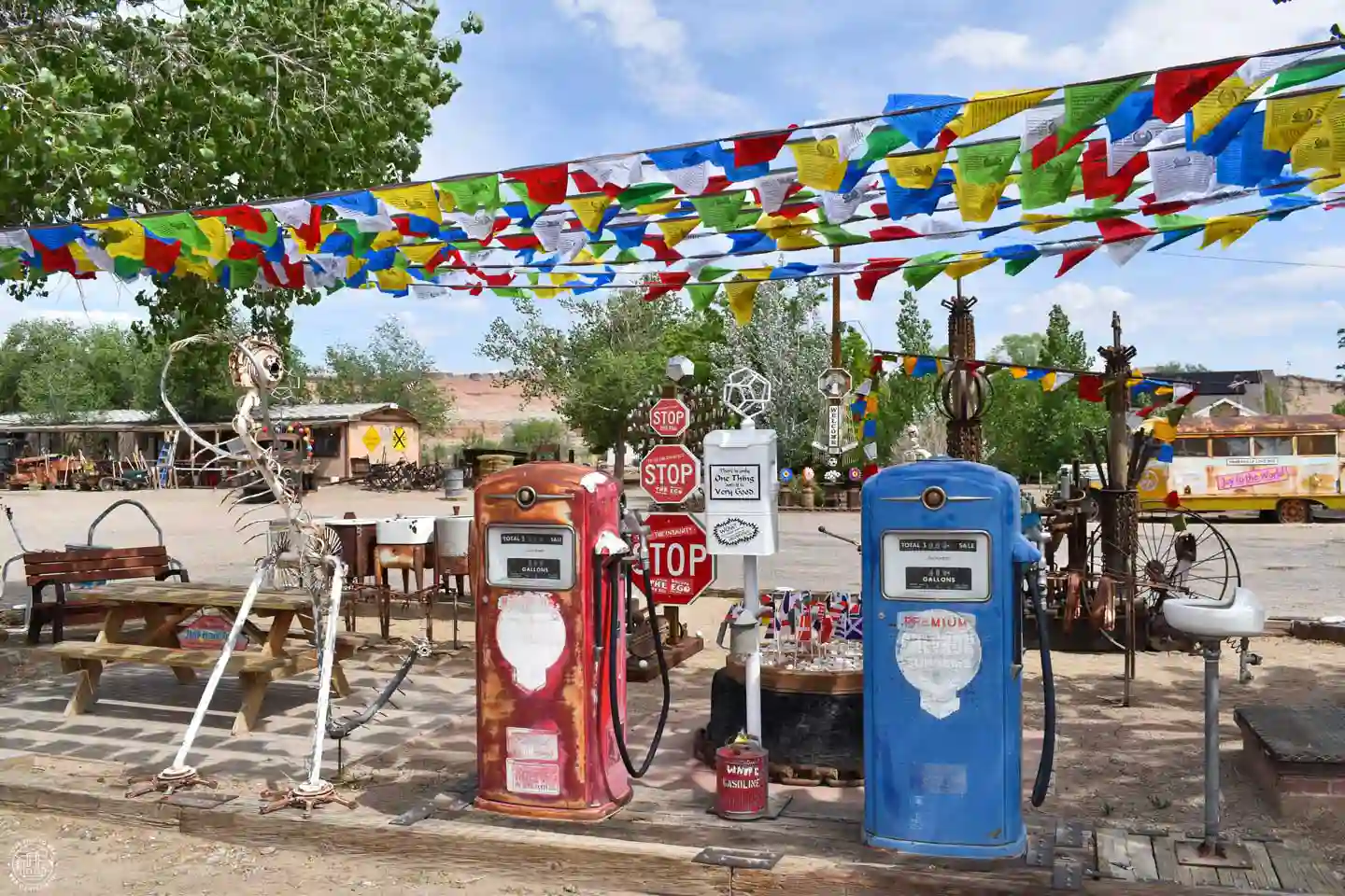
In the town of Hanksville, there are a couple of interesting spots worth a 5-minute stop. The first one you’ll come across, heading east, is Carl’s Critter Garden, the garden of a former roadside motel that has been transformed into an open-air art gallery. There you’ll find quirky creations made from scrap materials such as metal, plastic, glass, and fabric.
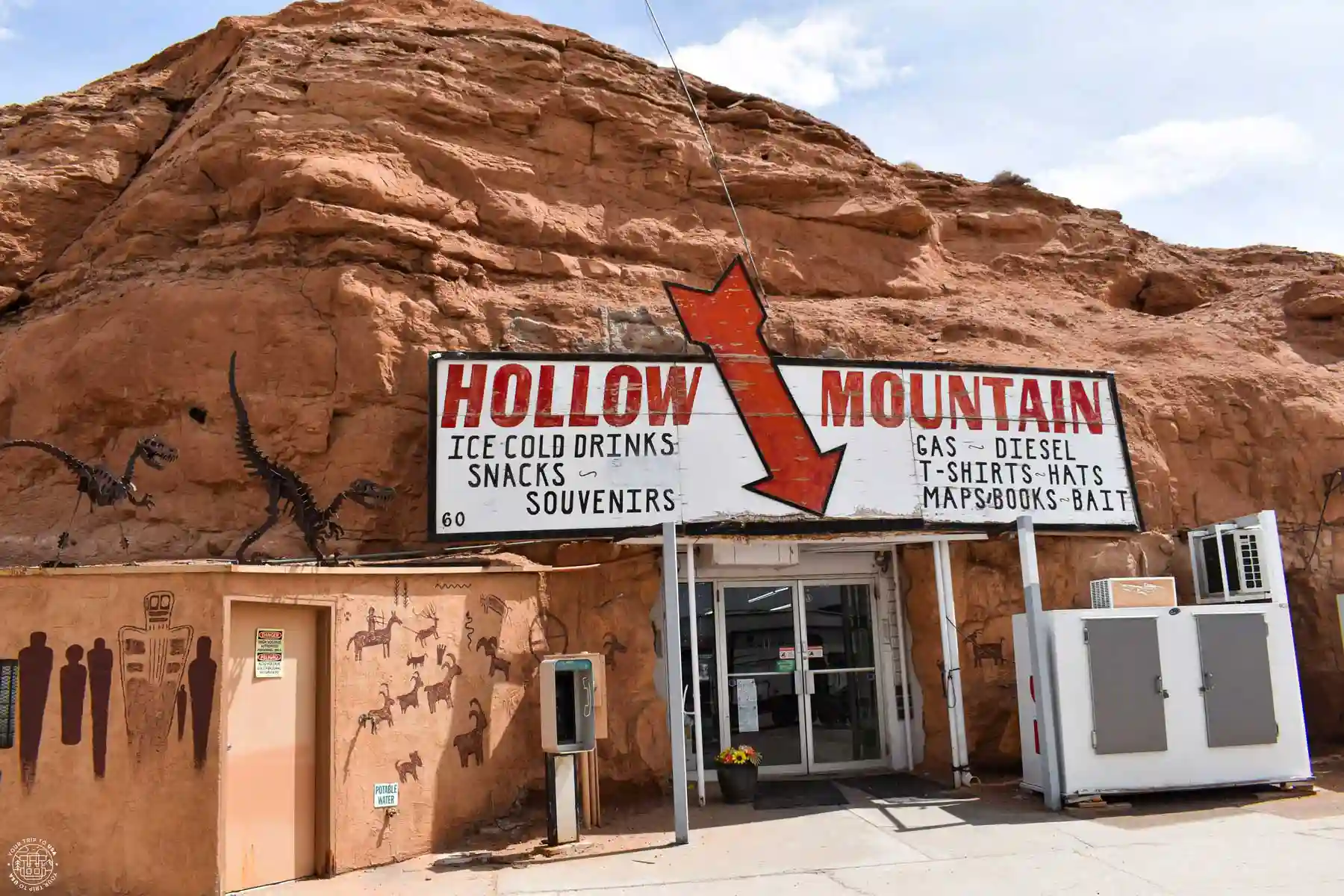
The second one is located at the intersection of Highway 24 and Highway 95, at the edge of town. It is Hollow Mountain, a cave-style gas station where the store is located inside a natural cave.
Goblin Valley State Park
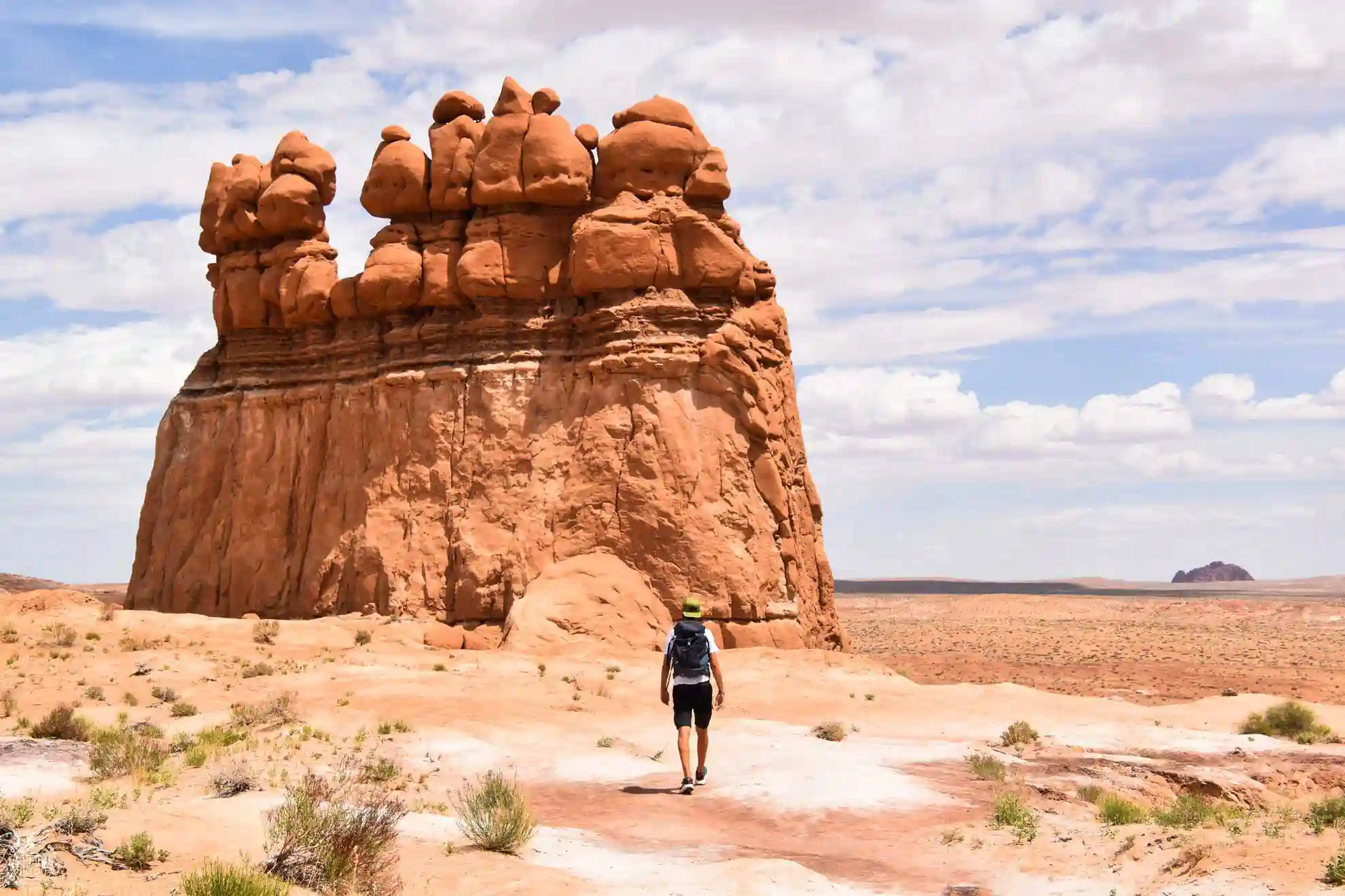
This state park is full of rock formations with incredible shapes, and while it’s not as impressive as Utah’s national parks, it’s definitely worth a visit. It looks like the set of a Disney movie and actually served as the filming location for a science fiction movie. In our post on how to visit Goblin Valley State Park (coming soon), you’ll find all the information you need.
Map of Things to Do in Capitol Reef
On this map of things to do in Capitol Reef, we've marked the best viewpoints, accommodations, guided activities, trails, visitor centers, and driving routes to help you explore the park:
Frequently Asked Questions About What to Do in Capitol Reef
What is the most important thing to see at Capitol Reef?
Among the must-see attractions in Capitol Reef are the Scenic Drive, Fruita, Hickman Bridge, Cassidy Arch, Goosenecks Overlook, Sunset Point, Cathedral Valley, and the stunning rock formations of the Waterpocket Fold.
How long does it take to see Capitol Reef?
To see Capitol Reef's main attractions, we recommend setting aside at least one full day. If you want to hike several trails and explore lesser-known areas, it's best to plan on spending 2 or 3 days there.
Can you visit Capitol Reef in one day?
Yes. In one day, you can visit the main attractions, go on a hike, and drive along the Scenic Drive. Of course, you'll have to choose your stops carefully to make the most of your time.
What is the most beautiful place in Capitol Reef?
It's hard to pick just one, but some of the most spectacular spots are Cassidy Arch, Hickman Bridge, Capitol Gorge, and Cathedral Valley.
What hiking trails are there in Capitol Reef?
Some of the best hiking trails are the Hickman Bridge Trail, the Cassidy Arch Trail, the Grand Wash Trail, and the Capitol Gorge Trail. There are options of varying difficulty levels and lengths.
What is the Waterpocket Fold?
The Waterpocket Fold is a massive geological feature nearly 100 miles (160 km) long, formed by the folding and erosion of rock layers over millions of years. It is one of the main geological features of Capitol Reef.
We hope this post on things to do in Capitol Reef helps you enjoy this magnificent place!