
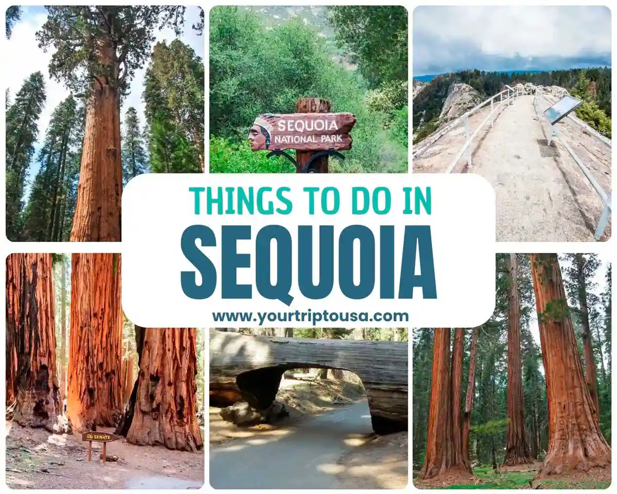
What to do in Sequoia National Park
Although there are plenty of things to see and do in Sequoia, these 15 must-see attractions will give you the chance to experience the very best the park has to offer. While it’s true that the last one is Kings Canyon National Park—which is a world by itself—we’ve included it because some of the spots are really close by, and if you have time, it’s definitely worth a visit.
Below, we've provided itineraries for half-day, 1-day, and 2-day trips to Sequoia National Park so you can follow them and make the most of your visit, depending on how much time you have.
💡Recommended: How to Visit Sequoia and Kings Canyon | Guide + Tips + Map |
And now, let's get to the places you can't miss!
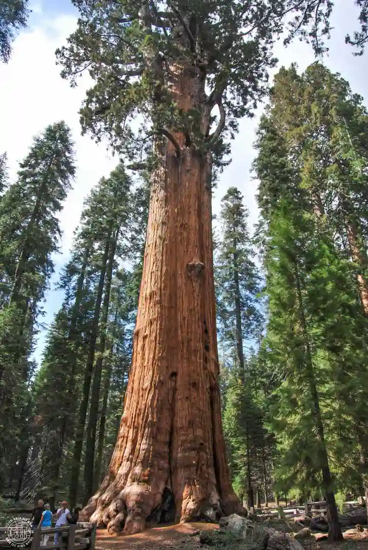
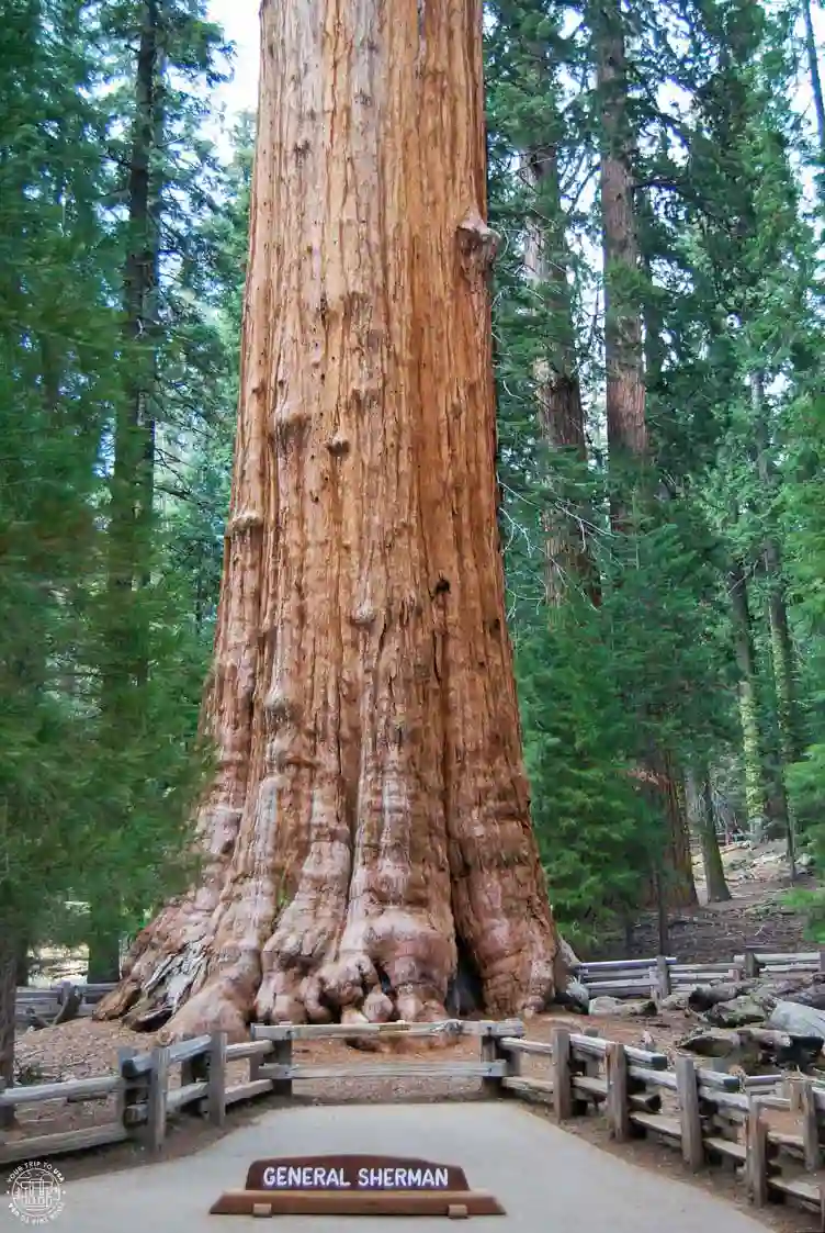
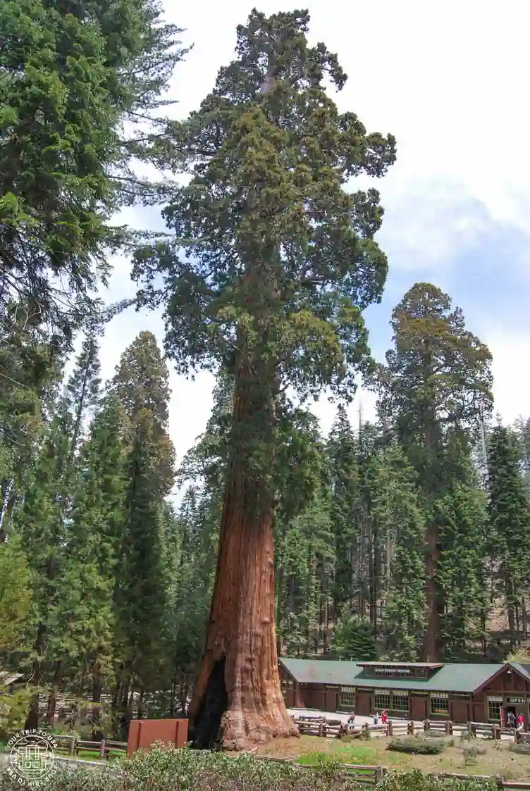
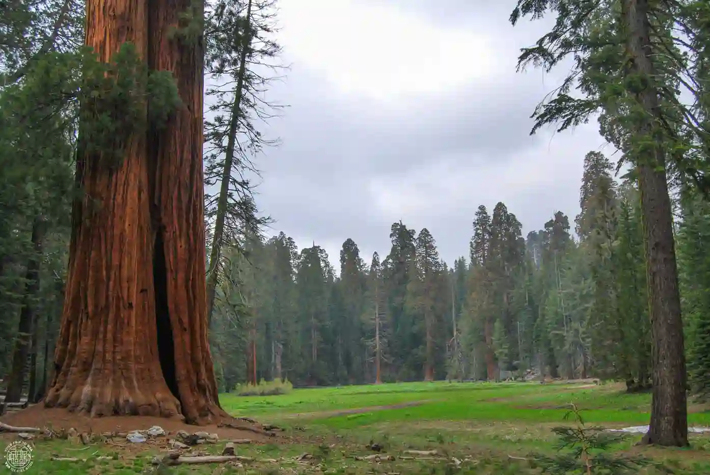
1. General Sherman
We couldn't start this list without first mentioning the General Sherman Tree, one of the most famous trees not only in the national park, but on the entire planet! This giant is the world's largest living tree by volume (though not by height, as that record is held by a redwood in Redwoods National Park). It's estimated to be between 2,300 and 2,700 years old 😲, making it one of the oldest trees in the world as well.
To see it, all you have to do is follow the General Sherman Tree Trail, located in the Giant Forest. It’s an easy 0.8-kilometer (0.5 mi) trail that winds through a forest with other sequoias, and since it’s downhill, you can gradually see the tree from the top to its base. Once you reach the end, you can walk back to the parking lot (it’s all uphill) or, if it’s peak season, you can take the orange (line 4) shuttle bus, which will drop you off back at the parking lot.
💡 As you can imagine, General Sherman is the star of the park, and everyone wants to see it. If you’re visiting during peak season, we recommend going first thing in the morning or late in the afternoon to find a parking spot. Otherwise, take shuttle bus line 1 (green), which departs from Giant Forest Museum and drops you off at the trailhead.
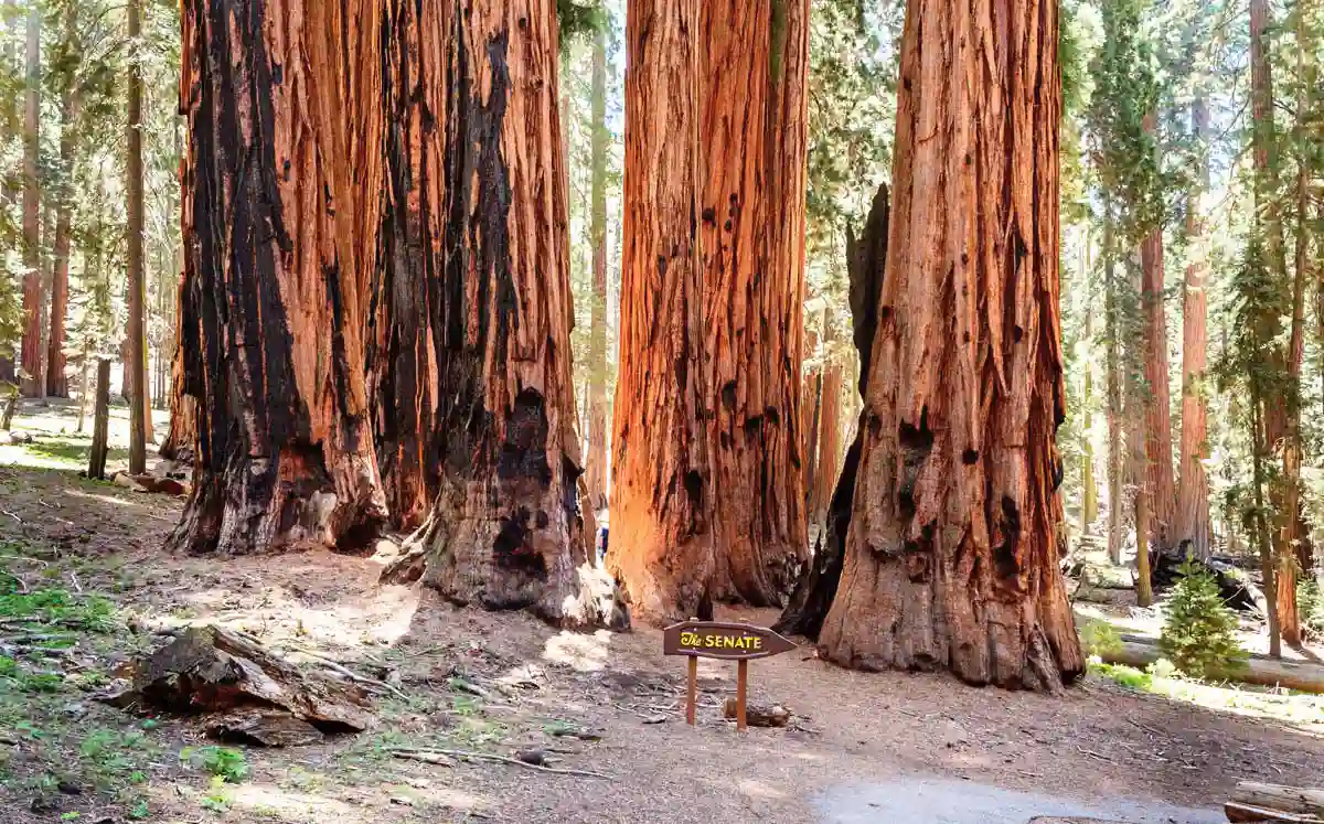
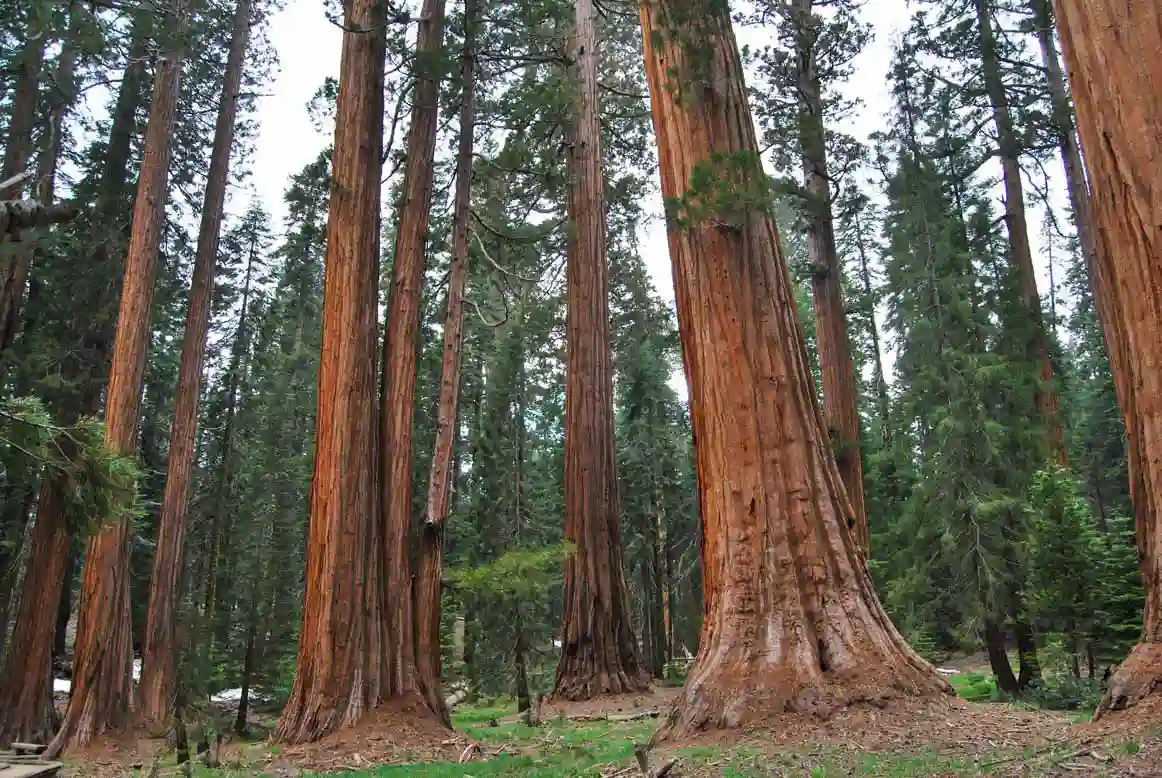
2. Congress Trail
The Congress Trail is an extension of the General Sherman Tree Trail and is one of the best hikes in Sequoia National Park. If you have time, take this very easy, paved 3.2-kilometer (2 mi) trail that will lead you through several groves of giant sequoias—it’s like something out of a fairy tale!
You'll have the chance to feel tiny next to trees like the McKinley Tree and the President Tree, though the most spectacular ones are at the end of the trail. These are the clusters known as The House and The Senate—they're colossal!
3. Giant Forest Museum
This site, which serves as both a museum and a visitor center, is the heart of the Giant Forest area, the park’s most visited district. It’s housed in a historic building, and inside you can learn about the history of the giant sequoias.
Stopping here will also give you the chance to see The Sentinel, a 78-meter-tall (256 ft) sequoia that makes the museum look like a toy in comparison.

DO YOU NEED A RENTAL CAR IN THE UNITED STATES?
Take a look at this search tool and get the best price!
During peak season, shuttle bus lines 1 (green) and 2 (grey) depart from here to take you to different locations in the Giant Forest/Lodgepole area. We recommend using this service (especially on weekends, during the holiday season, and on public holidays), as finding a parking spot in some areas can be a nightmare. This also helps reduce traffic congestion on the roads!
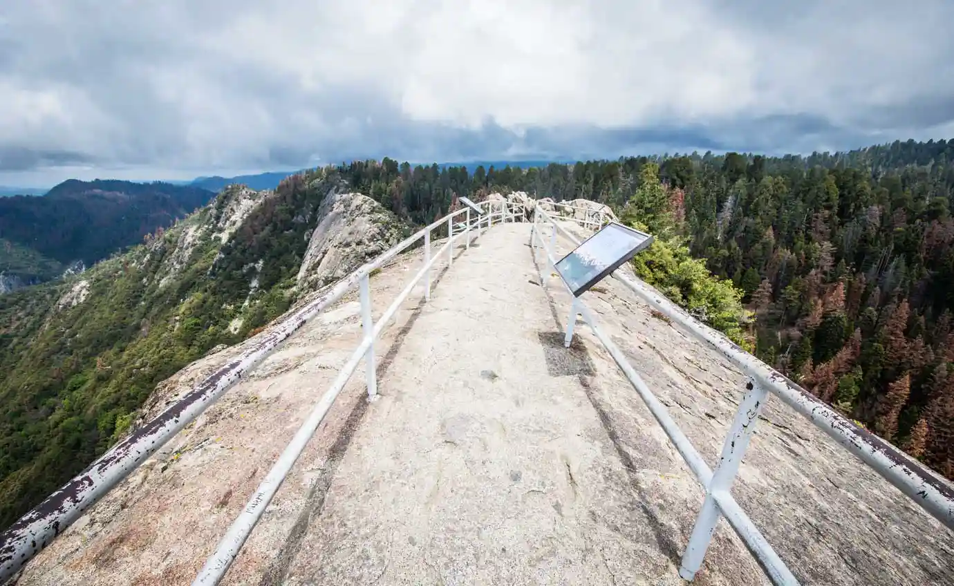
4. Moro Rock
Moro Rock is like Yosemite’s Half Dome—a massive granite monolith that holds the undisputed title of best viewpoint in Sequoia National Park. Climbing to the top can be a bit challenging for those with a fear of heights, as it involves ascending 350 steps along the rock’s ridge. The path is quite narrow in some places, but don’t worry—there are railings on both sides the whole way!
Once you reach the top, you'll really enjoy the stunning 360-degree views, including part of the Sierra Nevada mountain range and the San Joaquin Valley.
ℹ️ A few things to keep in mind when visiting Moro Rock:
- The parking lot is located on a side road off Crescent Meadow Road, called the Moro Rock Loop. There aren't many spaces, so it tends to fill up quickly.
- In the summer, Line 2 (grey) of the free shuttle service operates, departing from the Giant Forest Museum and dropping you off at the parking lot.
- On weekends, Crescent Meadow Road is closed to private vehicles, so the only way to get there is by shuttle. During the week, you can drive there without any problems.
- You can walk there from the Giant Forest Museum by following the Bear Hill Trail; it's a 2.7-kilometer (1.7 mi) one-way trip.
- In winter, the stairs are closed due to the risk of slipping on ice.
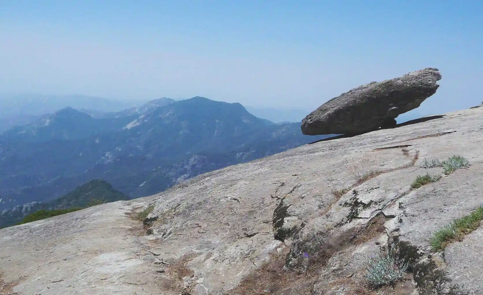
5. Hanging Rock
We’re still in the Giant Forest area to introduce you to one of the most overlooked spots in this famous region, even though it’s only a 250-meter (about 800 ft) walk to get there. This is likely due to its proximity to Moro Rock, where everyone goes in search of the perfect panoramic view, unaware that Hanging Rock also offers breathtaking views and is much easier to reach.
Hanging Rock is a massive boulder that defies the laws of gravity, as it appears to hang from the walls of the granite massif on which it sits. From here, you’ll have a perfect view of the hanging rock and, in the distance, Moro Rock, which takes on an orange hue at sunset.
💡Recommended: Where to Stay in Sequoia National Park | Areas + Hotels + Map |
ℹ️ To get there, take the Moro Rock Loop from Crescent Meadow Road; there’s a small parking lot just before the trailhead. Keep in mind that this road is closed to traffic on weekends during peak season, so in that case, you’ll need to take the shuttle, get off at the Moro Rock parking lot, and walk the 400 meters (a quarter mile) to the trailhead.
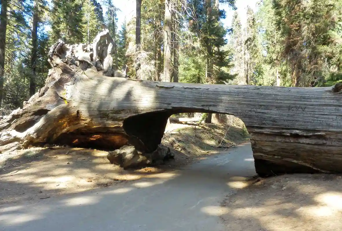
6. Tunnel Log
Located a few miles past Moro Rock, also on Crescent Meadow Road, is one of the most photographed spots in Sequoia National Park. It’s not every day you get to walk through a tunnel carved into the trunk of a sequoia!
The sequoia we're talking about fell in December 1937, blocking Crescent Meadow Road shortly after it was built. It was so heavy that, rather than remove it, they decided to cut a tunnel through its trunk, and it unexpectedly became a tourist attraction.
ℹ️ Things to keep in mind when viewing the Tunnel Log:
- The tunnel is 5.2 meters (17 ft) high and 2.4 meters (7.9 ft) wide. For vehicles larger than these dimensions, there is a detour.
- There's a parking lot just before it, but it's very small and fills up quickly. Many people park in the spaces along the side of the road, but keep in mind that blocking traffic isn't allowed.
- On weekends, the road is closed to private vehicles, so you’ll need to take the free shuttle from the Giant Forest Museum (grey Line 2). In this case, the bus doesn’t stop at Tunnel Log or go underneath it; instead, it takes the detour. If you’d like to take your time exploring, you should get off at the Moro Rock stop and finish the journey on foot; it’s about 1 km (0.6 mi).
7. Crescent Meadow
Crescent Meadow is a large meadow dotted with sequoias, located at the end of Crescent Meadow Road; it's particularly beautiful in the spring and early summer, when it's at its greenest and bloomed.
This is one of the best hikes in Sequoia National Park, as the 3-km (1.9 mi) loop trail is very easy and scenic, and if you go first thing in the morning or late in the afternoon, you have a good chance of spotting wildlife. In fact, it’s common to see black bears! We saw a mother bear with her cub from the bus.
Be sure to stop by the Chimney Tree, a sequoia trunk that was damaged in a fire in 1914, losing its interior and leaving only the bark. It's really interesting because you can actually go inside it!
ℹ️ Please note that during peak season, the access road is closed to private vehicles on weekends, and the only way to get there is by taking shuttle line 2 from the Giant Forest Museum.
8. Tharp's Log
Several trails start from Crescent Meadow, so if you have enough time, we invite you to take the one that leads to Log Meadow to see Tharp’s Log, a cabin built into the trunk of a sequoia. The Tharp’s Log loop is about 3 km (1.9 mi) long, but you can combine it with part of the Crescent Meadow loop to make a total of about 4 km (2.5 mi), visiting both sites and passing by the Chimney Tree.
Tharp's Log was built by Hale Tharp in 1861, a miner who arrived in California during the Gold Rush and decided to build a cabin there to tend to his cattle during the summer months. He became the first non-Native American to live in Giant Forest, where he remained for 29 years.
You can step inside the cabin and see the 21-meter-long (70 ft) hollow structure where Hale Tharp lived, as well as the wooden extension he built and the fireplace made of rocks.

INTERNET IN THE UNITED STATES
We have 2 discounts for you:
-30% OFF with eSIMFlag* ➡️ Unlimited data at the best price!
*Offer valid until June 30
-10% OFF with SimLocal ➡️ Best deal with limited data!
Discounts applied automatically
🤓 Take a loot at: Best SIMs & eSIMs for traveling to the USA
9. Big Trees Trail
The Big Trees Trail is a short and easy hike that starts at the Giant Forest Museum, making it one of the most popular trails in the park. It’s a 1-kilometer (0.6 mi) loop that circles Round Meadow, which is dotted with sequoias. Here you can learn a lot about how they grow from the informational signs.
10. Beetle Rock and Sunset Rock Trail
Beetle Rock and Sunset Rock are two other hikes that also start at the Giant Forest Museum and can be combined, since one connects to the other.
The shortest trail leads to Beetle Rock; it’s just 250 meters (820 ft) one way from the parking lot, or nearly 2 km (1.25 mi) if you’d like to do the full loop. From here, you’ll have panoramic views of the park’s west face, with the San Joaquin Valley at your feet. In the summer, it’s common to see a kind of smog that slightly obscures the landscape—it’s nothing more than pollution from the factories in Bakersfield.
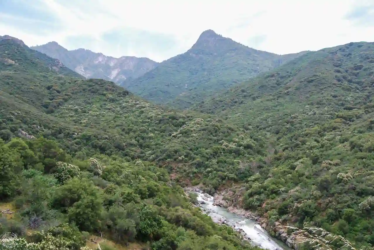
If you decide to head to Sunset Rock, a popular spot for watching the sunset, the hike extends to 3.2 km (2 mi) round-trip. You’ll pass through a coniferous forest until you reach the end, which offers views of Marble Fork Canyon carved out by the Kaweah River. It’s true that this area was severely affected by the major wildfire in 2021, and much of the vegetation that once stood there is now gone.
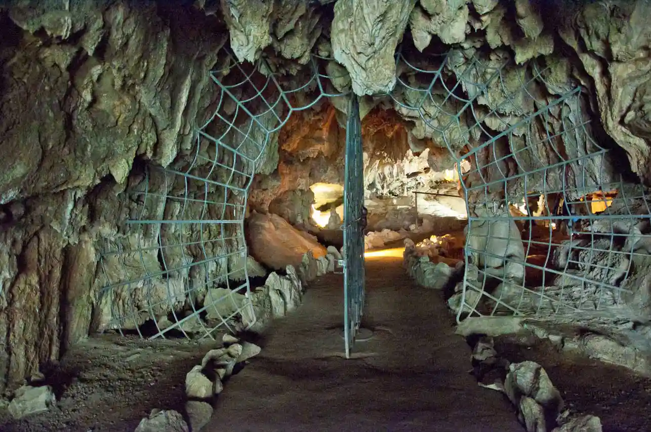
11. Crystal Cave
If you’d like to see more than just sequoias and overlooks, a visit to Crystal Cave is the perfect way to add some variety to your trip. This marble cave features several chambers and spectacular formations, but it can only be visited on a guided tour, which runs from mid-May to early November.
Tours depart every 30 minutes from 9:00 AM to 3:30 PM and cost $22 for adults and $11 for children under 10 (a 6% tax is added to this price). Reservations can be made here.
ℹ️ Things to keep in mind when visiting Crystal Cave:
- The access road, Crystal Cave Road, is 10 km (6.2 mi) long and narrow with many curves, so it takes about 30 minutes to drive. From the Ash Mountain Entrance, the total travel time is about 1 hour.
- Vehicles longer than 6.7 meters (22 ft) and trailers are prohibited from entering.
- You have to walk 800 meters (half a mile) round trip up a path with some stairs to reach the cave entrance.
- It's cold inside the cave (10°C or 50ºF), so be sure to wear appropriate clothing.
⚠️ White-nose syndrome is a fungal disease that affects bats and has killed millions of them in the U.S. and Canada. And it has reached California! Humans contribute to its spread through our shoes, clothing, and backpacks (even if you wash them). If you’ve been to other caves in the U.S., don’t wear the same clothes or shoes to Crystal Cave.
12. Tokopah Falls
In the Lodgepole area, an area bordered by the Marble Fork of the Kaweah River, there is a visitor center and one of the few lodges offering overnight accommodations within the park, the Wuksachi Lodge.
One of the main tourist attractions in this area is Tokopah Falls, a waterfall that cascades down granite cliffs and is truly spectacular if you’re lucky enough to see it when the water flow is high. For this reason, we recommend this hike in the spring and early summer to see the 365-meter (1,200 ft) drop in all its glory thanks to the spring thaw. Just be careful not to slip!
If you're visiting later in the summer, you can still explore this area and take advantage of the lower water level to cool off in the river.
ℹ️ The trail is 2.7 km (1.7 mi) long (one way) and has an elevation gain of just 160 meters (525 ft), so it’s an easy hike. The parking lot here is quite large, so you won’t usually have the parking problems you find at other places.
 DO YOU NEED A NO FEES CARD FOR YOUR TRIPS?
Get your Wise card here for free
Withdraw money and pay in other currencies without fees!
💳Check it out: Best Travel Cards for the USA | Comparison & Opinion |
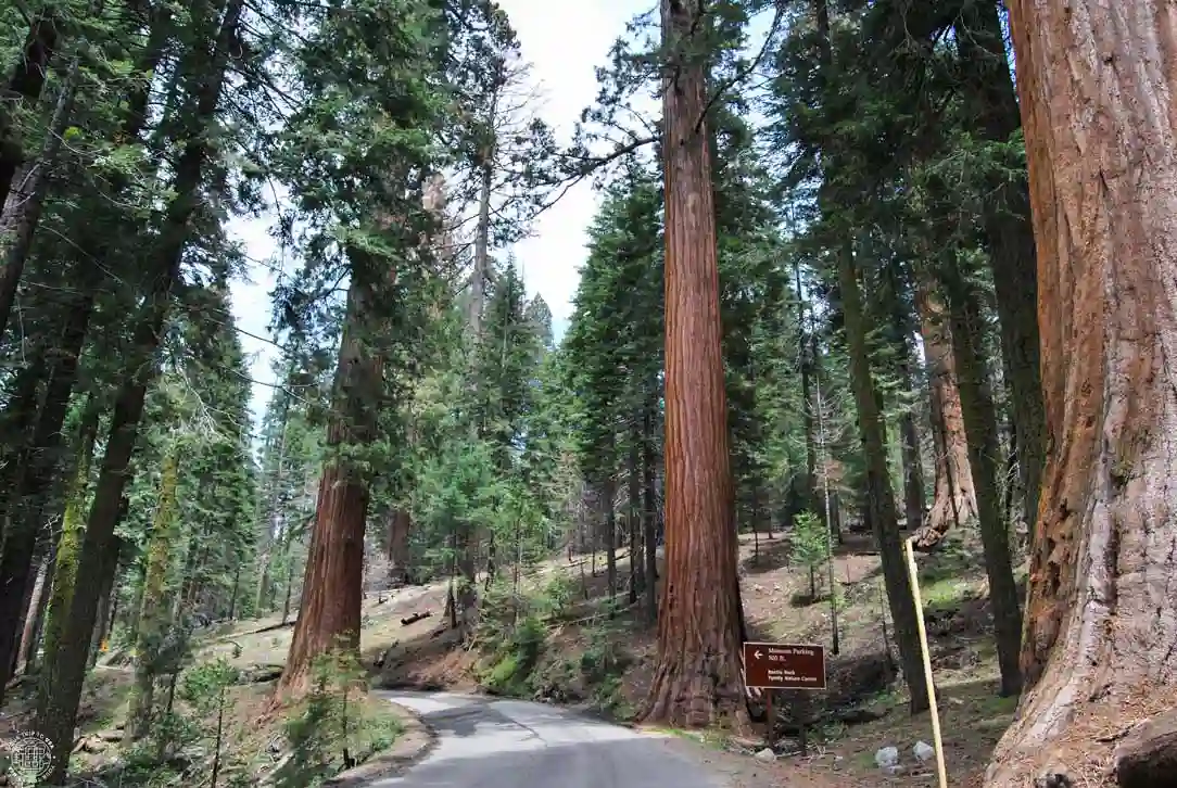
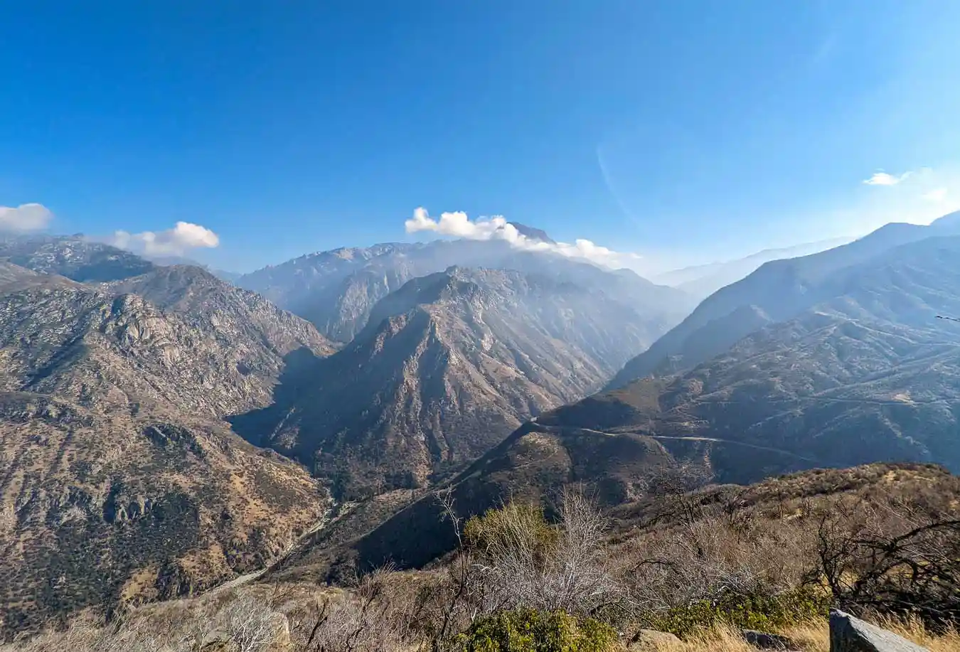
13. Generals Highway
Generals Highway is the park’s main road, with 72-kilometer (45 mi) from CA-180 in the north to the southern entrance. Driving along it's an attraction in itself from start to finish, but the southernmost section—which has the steepest gradients and most curves—is where you’ll find the most overlooks; if possible, you should stop at them:
- Eleven Range Overlook
- Vista Point
- Amphitheater Point
- Kaweah River Overlook
- Tunnel Rock
14. Mineral King Area
The Mineral King area is a hidden gem that you probably won’t get to see on your first visit to Sequoia National Park, unless you have several days. The main reason is the access: a 21-kilometer-long (13 mi) narrow road with steep inclines, sharp curves, and sections that aren’t paved.
For this reason, we only recommend visiting this more remote area if you’ve already been to Sequoia National Park or if you plan to spend at least one full day there, staying at the wonderful Silver City Mountain Resort or at one of the two campgrounds.
Mineral King is perfect for hiking enthusiasts and those who prefer less crowded spots. Here, the opportunities for mountain hikes are endless, especially if you love high-altitude lakes. Check out the trails leading to the Monarch Lakes, Crystal Lake, the Franklin Lakes, and Eagle & Mosquito Lakes, but keep in mind that these are long hikes with significant elevation gains.
15. Kings Canyon National Park
Although Kings Canyon is a completely different national park, it's located right next to Sequoia National Park, and the two operate as a single unit. The Grant Grove area is the closest section and is well worth a stop to round out your visit to Sequoia. If you enter the park via Big Stump, after a few miles you can turn off onto Generals Highway to visit Sequoia NP or continue 2.5 km (1.6 mi) along CA-180 toward the Grant Grove area.
Here, in addition to a small town with hotels like the John Muir Lodge, campgrounds, and a few restaurants, you’ll find the General Grant Tree, the second-largest tree in the world by volume after General Sherman. To reach it, you simply need to hike an easy 800-meters (0.5-mi) loop.
Since you're in the area, you might want to take the hike to Panoramic Point—it's just a very easy 0.8 km (0.5 mi) walk, and you'll be rewarded with spectacular views of the mountains, with Hume Lake taking center stage. To reach the trailhead, you'll need to drive 4 km (2.5 mi) along Panoramic Point Road, a fairly narrow, winding road.
If you want to explore Kings Canyon more thoroughly, you should spend a full day just for this park, since the other area (Cedar Grove) is completely separate and requires at least an hour’s drive to reach. That said, the access road is an attraction in itself. It’s beautiful!
Cedar Grove reminds to Yosemite, as it’s a glacial valley with massive granite formations. Here, you can go on longer hikes like the Don Cecil Trail and the Mist Falls Trail, or enjoy simpler activities such as visiting Roaring River Falls, exploring Zumwalt Meadow, or taking a refreshing dip at Muir Rock. You can even connect these last three spots on foot, creating a complete, easy, and scenic hike.
Best hikes in Sequoia National Park
Although we’ve already told you about some of the hikes in Sequoia National Park, we haven’t mentioned them all. If you’re looking to go hiking, here’s a summary of the best trails in the park.
Please note that for day hikes, you don't need to apply for a permit, unless you plan to climb Mt. Whitney. For multi-day hikes, you must obtain a wilderness permit. During peak season, permits must be reserved through recreation.gov and there is a fee; outside of these months, permits are free and can be obtained in person.
| HIKES IN SEQUOIA NATIONAL PARK | ||||
|---|---|---|---|---|
| Difficulty | Distance | Estimated time | Park area | |
| General Sherman Tree | 🟢 | 1.6 km (1 mi) round trip | 30 min | Giant Forest |
| Congress Trail | 🟢 | 3.2 km (2 mi) loop | 1 hr | Giant Forest |
| Moro Rock | 🟡 | 180 m (590 ft) round trip | 45 min - 1 hr | Giant Forest |
| Hanging Rock | 🟢 | 1 km (0.6 mi) round trip | 20 min | Giant Forest |
| Crescent Meadow | 🟢 | 3 km (1.9 mi) loop | 1 hr | Giant Forest |
| Tharp's Log | 🟢 | 3 km (1.9 mi) loop | 1 hr | Giant Forest |
| Eagle View | 🟡 | 2.4 km (1.5 mi) round trip | 1 hr - 1 hr 30 min | Giant Forest |
| Bear Hill Trail | 🟢 | 5.4 km (3.4 mi) round trip | 2 hrs | Giant Forest |
| Big Trees Trail | 🟢 | 1 km (0.6 mi) loop | 20 min | Giant Forest |
| Beetle Rock | 🟢 | 0.5 km (0.3 mi) round trip | 15 min | Giant Forest |
| Sunset Rock | 🟢 | 3.2 km (2 mi) round trip | 1 hr | Giant Forest |
| Hazelwood Nature Loop Trail | 🟢 | 1.1 km (0.7 mi) loop | 20 min | Giant Forest |
| Alta Trail | 🔴 | 22 km (13.7 mi) round trip | 6 hrs to 8 hrs | Lodgepole |
| High Sierra Trail | 🔴 | 79 km (49 mi) loop | 10 days | Giant Forest / Lodgepole |
| Lakes Trail | 🔴 | 20 km (12.4 mi) round trip | 6 hrs to 8 hrs | Lodgepole |
| Tokopah Falls | 🟢 | 5.4 km (3.4 mi) round trip | 2 hrs 30 min | Lodgepole |
| Monarch Lakes | 🟡 | 14 km (8.7 mi) round trip | 5 hrs | Mineral King |
| Crystal Lake | 🔴 | 16 km (10 mi) round trip | 6 hrs | Mineral King |
| Franklin Lakes | 🔴 | 17.4 km (10.8 mi) round trip | 7 hrs | Mineral King |
| Eagle & Mosquito Lakes | 🔴 | 16 km (10 mi) round trip | 6 hrs | Mineral King |
| General Grant Tree | 🟢 | 0.8 km (0.5 mi) loop | 15 min | Grant Grove (Kings Canyon) |
| Panoramic Point | 🟢 | 1.6 km (1 mi) round trip | 30 min | Grant Grove (Kings Canyon) |
| 🟢 easy, 🟡 moderate, 🔴 difficult | ||||
Half a day in Sequoia National Park (4–5 hours)
Although half a day isn't much time to explore Sequoia National Park, you might just be passing through on your U.S. Southwest itinerary and want to see only the park's must-see attractions.
Here is the itinerary we'd follow, assuming you enter from the north (Big Stump Entrance) and exit from the south (Ash Mountain Entrance).
- Access via Big Stump
- Drive to Grant Grove Village (🚗10 min)
- General Grant Tree (🚶🏼♀️15 min)
- Drive to General Sherman Tree parking lot (🚗1 hr)
- General Sherman Tree Trail (🚶🏼♀️30 min)
- Giant Forest Museum (🚗10 min + 🚶🏼♀️20 min)
- Big Trees Trail (🚶🏼♀️20 min)
- Tunnel Log (🚗 10 min)
- Crescent Meadow (🚗5 min + 🚶🏼♀️30 min – 1 hr)
- Viewpoints along the Generals Highway (🚗1 hr)
- Exit via Ash Mountain
1 day in Sequoia National Park
If you have a full day, you'll be able to do all of the above and visit some additional spots. This is the 1-day itinerary in Sequoia National Park we'd follow - if you have to skip a few places, it could be Tharp's Log or the hike to Hanging Rock.
- Access via Big Stump
- Drive to Grant Grove Village (🚗10 min)
- General Grant Tree (🚶🏼♀️15 min)
- Drive to General Sherman Tree parking lot (🚗1 hr)
- General Sherman Tree Trail (🚶🏼♀️30 min)
- Congress Trail (🚶🏼♀️1h)
- Giant Forest Museum (🚗10 min + 🚶🏼♀️20 min)
- Tunnel Log (🚗 10 min)
- Crescent Meadow and Tharp's Log (🚗5 min + 🚶🏼♀️1 hr 30 min)
- Hanging Rock (🚗10 min + 🚶🏼♀️20 min)
- Moro Rock (🚗1 min + 🚶🏼♀️45 min)
- Viewpoints along the Generals Highway (🚗1 hr)
- Exit via Ash Mountain
2 days in Sequoia National Park
With two days in Sequoia, you can try different itineraries:
2-day itinerary in Sequoia National Park (Grant Grove + Giant Forest + Lodgepole)
Here's what we'd do if you want to focus on exploring the Giant Forest and Lodgepole areas in depth, while also including the Grant Grove area of Kings Canyon National Park:
Day 1: Grant Grove + Lodgepole + Giant Forest
- Access via Big Stump
- Drive to Grant Grove Village (🚗10 min)
- General Grant Tree (🚶🏼♀️15 min)
- Drive to Lodgepole Road (🚗45 min)
- Hike to Tokopah Falls (🚶🏼♀️2.5 hours)
- Drive to the General Sherman Tree parking lot (🚗10 min)
- General Sherman Tree Trail (🚶🏼♀️30 min)
- Congress Trail (🚶🏼♀️1 hr)
- Giant Forest Museum (🚗10 min + 🚶🏼♀️15 min)
- Beetle Rock (🚶🏼♀️5 min)
- Big Trees Trail (🚶🏼♀️20 min)
For staying overnight, we recommend to do it at the Wuksachi Lodge, or, if you don't mind driving a bit further, choosing one of the lodges in Sequoia National Forest, such as the Montecito Sequoia Lodge or the Stony Creek Lodge.
Day 2: Giant Forest
- Drive to the Giant Forest Museum (🚗15 min from Wuksachi Lodge)
- Tunnel Log (🚗 10 min)
- Crescent Meadow and Tharp's Log (🚗5 min + 🚶🏼♀️1 hr 30 min)
- Hanging Rock (🚗10 min + 🚶🏼♀️20 min)
- Moro Rock (🚗1 min + 🚶🏼♀️45 min)
- Crystal Cave guided tour (🚗40 min + 🚶🏼♀️1 hr 10 min)
- Viewpoints along the Generals Highway (🚗1 hr)
- Exit via Ash Mountain
Keep in mind that Crystal Cave tours run until 3:30 p.m., so if you're short on time, it's best to skip one of the earlier hikes.
2 days in Sequoia National Park with Mineral King
In our opinion, a trip to Mineral King is recommended if you’ve already visited Sequoia National Park and are looking to explore new places, since getting there requires a bit of extra effort due to the access road. Also, the hikes in the area take a full day. In any case, if this is your first time and you’re determined to explore this more remote area, here’s what we'd do:
Day 1: Grant Grove + Giant Forest
- Access via Big Stump
- Drive to Grant Grove Village (🚗10 min)
- General Grant Tree (🚶🏼♀️15 min)
- Drive to General Sherman Tree parking lot (🚗1 hr)
- General Sherman Tree Trail (🚶🏼♀️30 min)
- Congress Trail (🚶🏼♀️1h)
- Giant Forest Museum (🚗10 min + 🚶🏼♀️20 min)
- Tunnel Log (🚗 10 min)
- Crescent Meadow (🚗5 min + 🚶🏼♀️1 hr)
- Moro Rock (🚗1 min + 🚶🏼♀️45 min)
- Drive to Mineral King, stopping at the overlooks along the Generals Highway (🚗 2 hrs)
Stay overnight at the charming Silver City Mountain Resort, the only hotel in the Mineral King area, or at one of its two campgrounds.
Day 2: Mineral King
If you've come all this way, it's to enjoy the natural beauty and high-mountain lakes of this area, so choose any of the hikes we've recommended in the section on the best treks in Sequoia National Park. The easiest of them all is the one that leads to Monarch Lakes.
Although we’ll be staying one more night at Silver City Mountain Resort, another option is to leave the park today once you’ve finished your hike.
2-day itinerary in Sequoia and Kings Canyon Parks
The last option is to take advantage of the proximity between Sequoia and Kings Canyon and spend a full day at each park. Here’s what we'd do, assuming you enter through the north entrance:
Day 1: Kings Canyon National Park (Grant Grove + Cedar Grove)
- Access via Big Stump
- Drive to Grant Grove Village (🚗10 min)
- General Grant Tree (🚶🏼♀️15 min)
- Panoramic Point (🚗10 min + 🚶🏼♀️30 min)
- Drive along the Kings Canyon Scenic Byway to Cedar Grove (🚗1 hr)
- Roaring River Falls (🚗10 min + 🚶🏼♀️20 min)
- Zumwalt Meadow Loop Trail (🚗5 min + 🚶🏼♀️1 hr)
- Swimming at Muir Rock (🚗5 min)
This day, the best option is to stay in Cedar Grove Village, where you can choose between the spectacular Cedar Grove Lodge or one of the 3 campgrounds in the area.
Day 2: Sequoia National Park (Giant Forest)
- Drive to General Sherman Tree parking lot (🚗2 hrs)
- General Sherman Tree Trail (🚶🏼♀️30 min)
- Congress Trail (🚶🏼♀️1h)
- Giant Forest Museum (🚗10 min + 🚶🏼♀️15 min)
- Tunnel Log (🚗 10 min)
- Crescent Meadow (🚗5 min + 🚶🏼♀️1 hr)
- Moro Rock (🚗1 min + 🚶🏼♀️45 min)
- Viewpoints along the Generals Highway (🚗1 hr)
- Exit via Ash Mountain
Map of attractions in Sequoia National Park
On this map, you'll find all the places and hikes we've mentioned throughout this post, as well as access points and lodging both inside and outside the park:
FAQs about things to do in Sequoia National Park
What are the must-see attractions in Sequoia?
Some of the places you shouldn’t miss include the General Sherman Tree, Moro Rock, Tunnel Log, Crescent Meadow, and the Giant Forest.
How many days do you need to visit Sequoia National Park?
Ideally, you should spend 1 to 2 days to explore the main attractions at a leisurely pace. In our guide about visiting Sequoia NP we talk deeply about this topic and others.
When is the best time to visit Sequoia?
The best time is from spring to fall. In winter, snow can limit access to some areas.
Can you explore Sequoia by car?
Yes, although during peak season you may have trouble finding parking at the main attractions. For this reason, we recommend using the free shuttle service.
What are the best hikes in Sequoia?
The hike up to Moro Rock, the Congress Trail, Crescent Meadow, and Tokopah Falls if you’re looking for something relatively easy. If you want longer and more challenging trails, the hikes to Monarch Lakes, Crystal Lake, and Eagle & Mosquito Lakes are perfect.
Can you visit Sequoia with children?
Yes, there are many accessible areas and easy trails, ideal for families.
What are the best viewpoints in Sequoia?
The most popular is Moro Rock, but there are others that are also worth visiting, such as Hanging Rock, Eagle View, and Sunset Rock.
We hope this post has helped you discover all the places to visit in Sequoia National Park!
Tunnel Log: Alexander Migl, CC BY-SA 4.0; Moro Rock: m01229 from USA, CC BY-SA 2.0; Congress Trail: dconvertini, CC BY-SA 2.0; Crystal Cave: qJake, CC BY-SA 2.0